Sico Uno geodata
Sico Uno (Calabarzon) is a populated place; located in Philippines in Asia/Manila (GMT+8) time zone. With population of 3,919 people, there are 1775 cities with bigger population in this country. Compared to other cities in Philippines, 65.9% of cities are located further ↓South; 69% of cities are located further →East and 54.4% of cities have lower elevation than Sico Uno. Note1


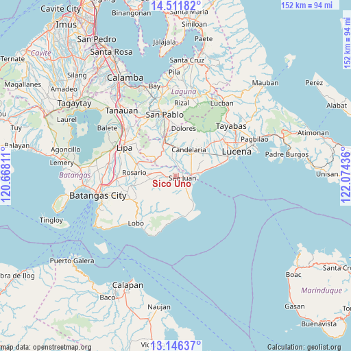
Sico Uno GPS coordinates[2]
13° 49' 48.36" North, 121° 22' 16.428" East
| Map corner | latitude | longitude |
|---|---|---|
| Upper-left | 14.51182°, | 120.66811° |
| Center: | 13.8301°, | 121.37123° |
| Lower-right: | 13.14637°, | 122.07436° |
| Map W x H: | 151.8×151.8 km | = 94.3×94.3mi |
| max Lat: | 20.78733° ⇑34.1% North |
| Sico Uno: | 13.8301° |
| min Lat: | ⇓65.9% South 4.65442° |
| min Long | Sico Uno | max Long |
| 117.04868° | 121.37123° | 126.58417° |
| W 31%⇐ | ⇒69% E |
Elevation
Elevation of Sico Uno is 27 m = 89 ft, and this is 60.9 m = 200 ft below average elevation for this country.
| Max E: |
2262 m = 7421 ft | 45.6% |
| Avg. | 87.9 m = 288 ft | |
| Sico Uno | 27 m = 89 ft | |
Min E: |
-2 m = -7 ft | 54.4% |
See also: Philippines elevation on elevation.city.
Geographical zone
Sico Uno is located in North Torrid zone (between Equator and Tropic of Cancer). Distance of this Northern Tropic circle is 1068.2 km =663.7 mi to North.| Distance of | km | miles | from Sico Uno |
|---|---|---|---|
| North Pole | 8469.3 | 5262.6 | to North |
| Arctic Circle | 5863.4 | 3643.3 | to North |
| Tropic Cancer | 1068.2 | 663.7 | to North |
| Equator | 1537.8 | 955.5 | to South |


Nearby cities:
15 places around Sico Uno: (largest is in red/bold)
• Alupay
7.2 km =4.5 mi,  285°
285°
• Cabay
4.6 km =2.9 mi,  11°
11°
• Libato
4.3 km =2.7 mi,  247°
247°
• Lipahan
3.4 km =2.1 mi,  77°
77°
• Macalamcam A
5.5 km =3.4 mi,  302°
302°
• Palahanan Uno
1.6 km =1 mi,  274°
274°
• Pinagsibaan
5.4 km =3.4 mi,  275°
275°
• Poctol
7.7 km =4.8 mi,  97°
97°
• Putingkahoy
4.7 km =2.9 mi, 270°
• Quipot
6.3 km =3.9 mi,  153°
153°
• Sampiro
5.3 km =3.3 mi,  164°
164°
• San Juan
2.9 km =1.8 mi, 81°
• Santa Catalina Norte
4.8 km =3 mi,  341°
341°
• Talahiban I
2.8 km =1.7 mi, 157°
• Tipaz
5.8 km =3.6 mi,  91°
91°
Sources, notices
• [Note1] Compared only with cities in Philippines existing in our database
• [Src1] Map data: © OpenStreetMap contributors (CC-BY-SA)
• [Src2] Other city data from geonames.org with taken over terms of usage.
• [Src3] Geographical zone / Annual Mean Temperature by Robert A. Rohde @ Wikipedia
