Tabon geodata
Tabon (Central Visayas) is a populated place; located in Philippines in Asia/Manila (GMT+8) time zone. With population of 2,878 people, there are 2666 cities with bigger population in this country. Compared to other cities in Philippines, 65.1% of cities are located further ↑North; 58.9% of cities are located further ←West and 70.2% of cities have higher elevation than Tabon. Note1
Administrative division(s):
- Level 1: Central Visayas
- Level 2: Province of Negros Oriental
- Level 3: Vallehermoso


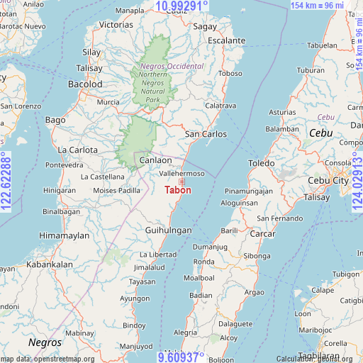
Tabon GPS coordinates[2]
10° 18' 6.84" North, 123° 19' 33.6" East
| Map corner | latitude | longitude |
|---|---|---|
| Upper-left | 10.99291°, | 122.62288° |
| Center: | 10.3019°, | 123.326° |
| Lower-right: | 9.60937°, | 124.02913° |
| Map W x H: | 153.8×153.8 km | = 95.6×95.6mi |
| max Lat: | 20.78733° ⇑65.1% North |
| Tabon: | 10.3019° |
| min Lat: | ⇓34.9% South 4.65442° |
| min Long | Tabon | max Long |
| 117.04868° | 123.326° | 126.58417° |
| W 58.9%⇐ | ⇒41.1% E |
Elevation
Elevation of Tabon is 12 m = 39 ft, and this is 75.9 m = 249 ft below average elevation for this country.
| Max E: |
2262 m = 7421 ft | 70.2% |
| Avg. | 87.9 m = 288 ft | |
| Tabon | 12 m = 39 ft | |
Min E: |
-2 m = -7 ft | 29.8% |
See also: Philippines elevation on elevation.city.
Geographical zone
Tabon is located in North Torrid zone (between Equator and Tropic of Cancer). Distance of Equator is 1145.5 km =711.8 mi to South.| Distance of | km | miles | from Tabon |
|---|---|---|---|
| North Pole | 8861.6 | 5506.3 | to North |
| Arctic Circle | 6255.7 | 3887.1 | to North |
| Tropic Cancer | 1460.5 | 907.5 | to North |
| Equator | 1145.5 | 711.8 | to South |


Nearby cities:
15 places around Tabon: (largest is in red/bold)
• Anopog
10.1 km =6.3 mi,  235°
235°
• Basak
8.7 km =5.4 mi,  194°
194°
• Buenavista
20.3 km =12.6 mi,  206°
206°
• Buluangan
9.6 km =6 mi,  7°
7°
• Calamba
14.8 km =9.2 mi,  198°
198°
• Canlaon
14.7 km =9.1 mi,  309°
309°
• Codcod
19.8 km =12.3 mi,  335°
335°
• Guadalupe
17.7 km =11 mi,  16°
16°
• Guba
6.6 km =4.1 mi,  280°
280°
• Hibaiyo
3.3 km =2.1 mi, 189°
• Malaiba
3.6 km =2.2 mi, 343°
• Malusay
18.5 km =11.5 mi, 198°
• Pinokawan
5.6 km =3.5 mi,  321°
321°
• Quezon
16.6 km =10.3 mi,  334°
334°
• Vallehermoso
3.7 km =2.3 mi,  359°
359°
Sources, notices
• [Note1] Compared only with cities in Philippines existing in our database
• [Src1] Map data: © OpenStreetMap contributors (CC-BY-SA)
• [Src2] Other city data from geonames.org with taken over terms of usage.
• [Src3] Geographical zone / Annual Mean Temperature by Robert A. Rohde @ Wikipedia
