Buenavista geodata
Buenavista (Central Visayas) is a populated place; located in Philippines in Asia/Manila (GMT+8) time zone. With population of 4,442 people, there are 1523 cities with bigger population in this country. Compared to other cities in Philippines, 66.9% of cities are located further ↑North; 57.2% of cities are located further ←West and 74.3% of cities have lower elevation than Buenavista. Note1
Administrative division(s):
- Level 1: Central Visayas
- Level 2: Province of Negros Oriental
- Level 3: City of Guihulngan


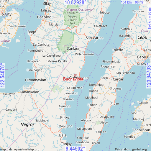
Buenavista GPS coordinates[2]
10° 8' 16.44" North, 123° 14' 38.04" East
| Map corner | latitude | longitude |
|---|---|---|
| Upper-left | 10.82928°, | 122.54078° |
| Center: | 10.1379°, | 123.2439° |
| Lower-right: | 9.44502°, | 123.94703° |
| Map W x H: | 153.9×153.9 km | = 95.6×95.6mi |
| max Lat: | 20.78733° ⇑66.9% North |
| Buenavista: | 10.1379° |
| min Lat: | ⇓33.1% South 4.65442° |
| min Long | Buenavista | max Long |
| 117.04868° | 123.2439° | 126.58417° |
| W 57.2%⇐ | ⇒42.8% E |
Elevation
Elevation of Buenavista is 66 m = 217 ft, and this is 21.9 m = 72 ft below average elevation for this country.
| Max E: |
2262 m = 7421 ft | 25.7% |
| Avg. | 87.9 m = 288 ft | |
| Buenavista | 66 m = 217 ft | |
Min E: |
-2 m = -7 ft | 74.3% |
See also: Philippines elevation on elevation.city.
Geographical zone
Buenavista is located in North Torrid zone (between Equator and Tropic of Cancer). Distance of Equator is 1127.2 km =700.4 mi to South.| Distance of | km | miles | from Buenavista |
|---|---|---|---|
| North Pole | 8879.8 | 5517.7 | to North |
| Arctic Circle | 6273.9 | 3898.4 | to North |
| Tropic Cancer | 1478.7 | 918.8 | to North |
| Equator | 1127.2 | 700.4 | to South |


Nearby cities:
15 places around Buenavista: (largest is in red/bold)
• Anopog
12.5 km =7.8 mi,  3°
3°
• Balogo
8.4 km =5.2 mi,  252°
252°
• Basak
12 km =7.5 mi,  34°
34°
• Calamba
6 km =3.7 mi,  45°
45°
• Dumanjog
22.9 km =14.2 mi,  113°
113°
• Guba
19.6 km =12.2 mi,  7°
7°
• Guihulñgan
3.8 km =2.4 mi,  118°
118°
• Hibaiyo
17.2 km =10.7 mi, 29°
• Jimalalud
18.2 km =11.3 mi,  195°
195°
• La Libertad
12.4 km =7.7 mi,  185°
185°
• Malusay
3.1 km =1.9 mi,  77°
77°
• McKinley
6.2 km =3.9 mi,  164°
164°
• Padre Zamora
7.9 km =4.9 mi,  175°
175°
• Saavedra
22 km =13.7 mi,  140°
140°
• Tabon
20.3 km =12.6 mi, 26°
Sources, notices
• [Note1] Compared only with cities in Philippines existing in our database
• [Src1] Map data: © OpenStreetMap contributors (CC-BY-SA)
• [Src2] Other city data from geonames.org with taken over terms of usage.
• [Src3] Geographical zone / Annual Mean Temperature by Robert A. Rohde @ Wikipedia
