Sugal geodata
Sugal (Davao) is a populated place; located in Philippines in Asia/Manila (GMT+8) time zone. With population of 2,759 people, there are 2856 cities with bigger population in this country. Compared to other cities in Philippines, 99.2% of cities are located further ↑North; 93% of cities are located further ←West and 68% of cities have lower elevation than Sugal. Note1
Administrative division(s):
- Level 1: Davao
- Level 2: Davao Occidental
- Level 3: Jose Abad Santos (Trinidad)


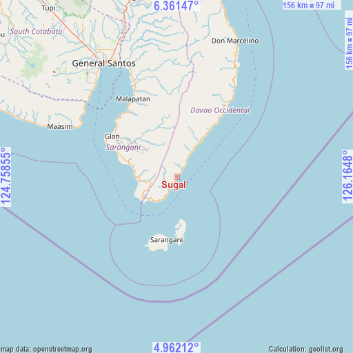
Sugal GPS coordinates[2]
5° 39' 43.992" North, 125° 27' 42.012" East
| Map corner | latitude | longitude |
|---|---|---|
| Upper-left | 6.36147°, | 124.75855° |
| Center: | 5.66222°, | 125.46167° |
| Lower-right: | 4.96212°, | 126.1648° |
| Map W x H: | 155.6×155.6 km | = 96.7×96.7mi |
| max Lat: | 20.78733° ⇑99.2% North |
| Sugal: | 5.66222° |
| min Lat: | ⇓0.8% South 4.65442° |
| min Long | Sugal | max Long |
| 117.04868° | 125.46167° | 126.58417° |
| W 93%⇐ | ⇒7% E |
Elevation
Elevation of Sugal is 48 m = 157 ft, and this is 39.9 m = 131 ft below average elevation for this country.
| Max E: |
2262 m = 7421 ft | 32% |
| Avg. | 87.9 m = 288 ft | |
| Sugal | 48 m = 157 ft | |
Min E: |
-2 m = -7 ft | 68% |
See also: Philippines elevation on elevation.city.
Geographical zone
Sugal is located in North Torrid zone (between Equator and Tropic of Cancer). Distance of Equator is 629.6 km =391.2 mi to South.| Distance of | km | miles | from Sugal |
|---|---|---|---|
| North Pole | 9377.5 | 5826.9 | to North |
| Arctic Circle | 6771.6 | 4207.7 | to North |
| Tropic Cancer | 1976.3 | 1228 | to North |
| Equator | 629.6 | 391.2 | to South |


Nearby cities:
15 places around Sugal: (largest is in red/bold)
• Balangonan
15.5 km =9.6 mi,  230°
230°
• Baliton
26.5 km =16.5 mi,  289°
289°
• Bukid
11.8 km =7.3 mi,  211°
211°
• Burias
23.8 km =14.8 mi, 285°
• Butulan
6.3 km =3.9 mi, 211°
• Caburan
34.7 km =21.6 mi,  34°
34°
• Glan
33.8 km =21 mi,  302°
302°
• Glan Peidu
34.4 km =21.4 mi,  308°
308°
• Ilaya
31.1 km =19.3 mi, 303°
• Kablalan
32 km =19.9 mi, 294°
• Kalbay
7.9 km =4.9 mi, 31°
• Kiupo
25.4 km =15.8 mi,  321°
321°
• Nuing
4.4 km =2.7 mi,  221°
221°
• Pangyan
20.4 km =12.7 mi,  282°
282°
• Sarangani
28.8 km =17.9 mi,  179°
179°
Sources, notices
• [Note1] Compared only with cities in Philippines existing in our database
• [Src1] Map data: © OpenStreetMap contributors (CC-BY-SA)
• [Src2] Other city data from geonames.org with taken over terms of usage.
• [Src3] Geographical zone / Annual Mean Temperature by Robert A. Rohde @ Wikipedia
