Balangonan geodata
Balangonan (Davao) is a populated place; located in Philippines in Asia/Manila (GMT+8) time zone. With population of 2,329 people, there are 3612 cities with bigger population in this country. Compared to other cities in Philippines, 99.3% of cities are located further ↑North; 91.8% of cities are located further ←West and 80.7% of cities have higher elevation than Balangonan. Note1
Administrative division(s):
- Level 1: Davao
- Level 2: Davao Occidental
- Level 3: Jose Abad Santos (Trinidad)


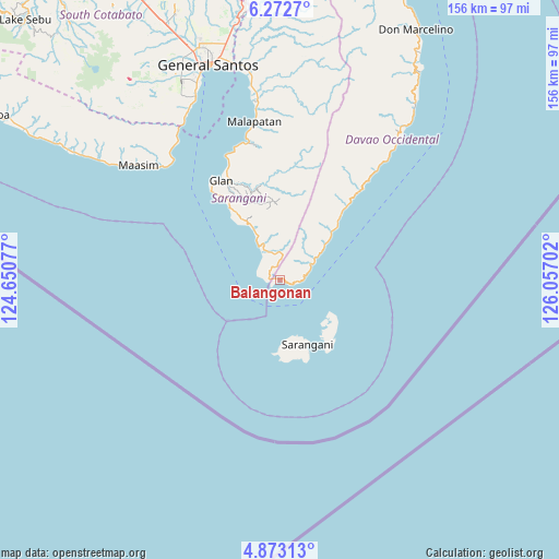
Balangonan GPS coordinates[2]
5° 34' 23.988" North, 125° 21' 14.004" East
| Map corner | latitude | longitude |
|---|---|---|
| Upper-left | 6.2727°, | 124.65077° |
| Center: | 5.57333°, | 125.35389° |
| Lower-right: | 4.87313°, | 126.05702° |
| Map W x H: | 155.6×155.6 km | = 96.7×96.7mi |
| max Lat: | 20.78733° ⇑99.3% North |
| Balangonan: | 5.57333° |
| min Lat: | ⇓0.7% South 4.65442° |
| min Long | Balangonan | max Long |
| 117.04868° | 125.35389° | 126.58417° |
| W 91.8%⇐ | ⇒8.2% E |
Elevation
Elevation of Balangonan is 9 m = 30 ft, and this is 78.9 m = 259 ft below average elevation for this country.
| Max E: |
2262 m = 7421 ft | 80.7% |
| Avg. | 87.9 m = 288 ft | |
| Balangonan | 9 m = 30 ft | |
Min E: |
-2 m = -7 ft | 19.3% |
See also: Philippines elevation on elevation.city.
Geographical zone
Balangonan is located in North Torrid zone (between Equator and Tropic of Cancer). Distance of Equator is 619.7 km =385.1 mi to South.| Distance of | km | miles | from Balangonan |
|---|---|---|---|
| North Pole | 9387.4 | 5833.1 | to North |
| Arctic Circle | 6781.5 | 4213.8 | to North |
| Tropic Cancer | 1986.2 | 1234.2 | to North |
| Equator | 619.7 | 385.1 | to South |


Nearby cities:
15 places around Balangonan: (largest is in red/bold)
• Baliton
23 km =14.3 mi,  325°
325°
• Bukid
5.7 km =3.5 mi,  91°
91°
• Burias
19.5 km =12.1 mi, 325°
• Butulan
9.7 km =6 mi,  62°
62°
• Glan
32.5 km =20.2 mi, 329°
• Glan Peidu
34.7 km =21.6 mi, 334°
• Ilaya
30.4 km =18.9 mi, 332°
• Kablalan
28.7 km =17.8 mi,  323°
323°
• Kalbay
23.1 km =14.4 mi,  43°
43°
• Kiupo
30.1 km =18.7 mi,  352°
352°
• Nuing
11.2 km =7 mi,  53°
53°
• Pangyan
16.3 km =10.1 mi, 330°
• Sarangani
22.5 km =14 mi,  147°
147°
• Sugal
15.5 km =9.6 mi, 50°
• Taluya
33.2 km =20.6 mi, 322°
Sources, notices
• [Note1] Compared only with cities in Philippines existing in our database
• [Src1] Map data: © OpenStreetMap contributors (CC-BY-SA)
• [Src2] Other city data from geonames.org with taken over terms of usage.
• [Src3] Geographical zone / Annual Mean Temperature by Robert A. Rohde @ Wikipedia
