Culaba geodata
Culaba (Eastern Visayas) is a seat of a third-order administrative division; located in Philippines in Asia/Manila (GMT+8) time zone. With population of 6,231 people, there are 999 cities with bigger population in this country. Compared to other cities in Philippines, 50.2% of cities are located further ↓South; 79.6% of cities are located further ←West and 99.6% of cities have higher elevation than Culaba. Note1


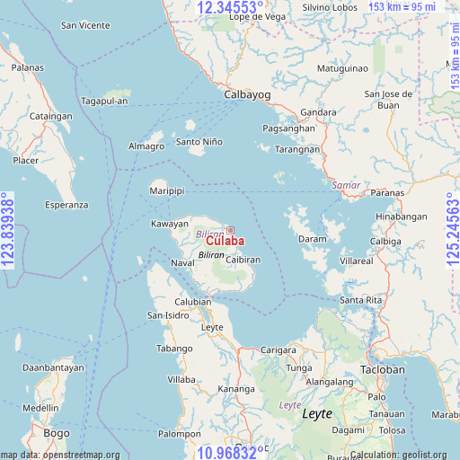
Culaba GPS coordinates[2]
11° 39' 28.008" North, 124° 32' 33" East
| Map corner | latitude | longitude |
|---|---|---|
| Upper-left | 12.34553°, | 123.83938° |
| Center: | 11.65778°, | 124.5425° |
| Lower-right: | 10.96832°, | 125.24563° |
| Map W x H: | 153.1×153.1 km | = 95.1×95.1mi |
| max Lat: | 20.78733° ⇑49.8% North |
| Culaba: | 11.65778° |
| min Lat: | ⇓50.2% South 4.65442° |
| min Long | Culaba | max Long |
| 117.04868° | 124.5425° | 126.58417° |
| W 79.6%⇐ | ⇒20.4% E |
Elevation
Elevation of Culaba is 1 m = 3 ft, and this is 86.9 m = 285 ft below average elevation for this country.
| Max E: |
2262 m = 7421 ft | 99.6% |
| Avg. | 87.9 m = 288 ft | |
| Culaba | 1 m = 3 ft | |
Min E: |
-2 m = -7 ft | 0.4% |
See also: Philippines elevation on elevation.city.
Geographical zone
Culaba is located in North Torrid zone (between Equator and Tropic of Cancer). Distance of Equator is 1296.2 km =805.4 mi to South.| Distance of | km | miles | from Culaba |
|---|---|---|---|
| North Pole | 8710.8 | 5412.6 | to North |
| Arctic Circle | 6105 | 3793.5 | to North |
| Tropic Cancer | 1309.7 | 813.8 | to North |
| Equator | 1296.2 | 805.4 | to South |


Nearby cities:
15 places around Culaba: (largest is in red/bold)
• Almeria
18 km =11.2 mi,  256°
256°
• Balagui
20.3 km =12.6 mi,  183°
183°
• Biliran
22.5 km =14 mi,  199°
199°
• Bunga
20.1 km =12.5 mi,  164°
164°
• Cabucgayan
21 km =13 mi,  170°
170°
• Caibiran
10.5 km =6.5 mi, 155°
• Calubian
26.5 km =16.5 mi,  208°
208°
• Caraycaray
18 km =11.2 mi,  230°
230°
• Catmon
18.2 km =11.3 mi,  221°
221°
• Daram
27.6 km =17.1 mi,  95°
95°
• Kawayan
20.4 km =12.7 mi,  276°
276°
• Looc
19.9 km =12.4 mi, 176°
• Maripipi
25 km =15.5 mi,  302°
302°
• Naval
19.1 km =11.9 mi,  235°
235°
• Tucdao
9.1 km =5.7 mi, 302°
Sources, notices
• [Note1] Compared only with cities in Philippines existing in our database
• [Src1] Map data: © OpenStreetMap contributors (CC-BY-SA)
• [Src2] Other city data from geonames.org with taken over terms of usage.
• [Src3] Geographical zone / Annual Mean Temperature by Robert A. Rohde @ Wikipedia
