Santa Cruz geodata
Santa Cruz (Central Visayas) is a populated place; located in Philippines in Asia/Manila (GMT+8) time zone. With population of 4,339 people, there are 1565 cities with bigger population in this country. Compared to other cities in Philippines, 61.5% of cities are located further ↑North; 76.3% of cities are located further ←West and 62.2% of cities have lower elevation than Santa Cruz. Note1
Administrative division(s):
- Level 1: Central Visayas
- Level 2: Province of Cebu
- Level 3: San Francisco


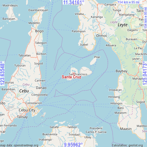
Santa Cruz GPS coordinates[2]
10° 39' 5.04" North, 124° 20' 18.96" East
| Map corner | latitude | longitude |
|---|---|---|
| Upper-left | 11.34161°, | 123.63548° |
| Center: | 10.6514°, | 124.3386° |
| Lower-right: | 9.95962°, | 125.04173° |
| Map W x H: | 153.7×153.7 km | = 95.5×95.5mi |
| max Lat: | 20.78733° ⇑61.5% North |
| Santa Cruz: | 10.6514° |
| min Lat: | ⇓38.5% South 4.65442° |
| min Long | Santa Cruz | max Long |
| 117.04868° | 124.3386° | 126.58417° |
| W 76.3%⇐ | ⇒23.7% E |
Elevation
Elevation of Santa Cruz is 37 m = 121 ft, and this is 50.9 m = 167 ft below average elevation for this country.
| Max E: |
2262 m = 7421 ft | 37.8% |
| Avg. | 87.9 m = 288 ft | |
| Santa Cruz | 37 m = 121 ft | |
Min E: |
-2 m = -7 ft | 62.2% |
See also: Philippines elevation on elevation.city.
Geographical zone
Santa Cruz is located in North Torrid zone (between Equator and Tropic of Cancer). Distance of Equator is 1184.3 km =735.9 mi to South.| Distance of | km | miles | from Santa Cruz |
|---|---|---|---|
| North Pole | 8822.7 | 5482.2 | to North |
| Arctic Circle | 6216.8 | 3862.9 | to North |
| Tropic Cancer | 1421.6 | 883.3 | to North |
| Equator | 1184.3 | 735.9 | to South |


Nearby cities:
15 places around Santa Cruz: (largest is in red/bold)
• Bantiqui
31.5 km =19.6 mi,  15°
15°
• Bilwang
29.3 km =18.2 mi,  28°
28°
• Consuelo
4.5 km =2.8 mi,  245°
245°
• Esperanza
6 km =3.7 mi,  333°
333°
• Esperanza
10 km =6.2 mi,  55°
55°
• Himensulan
8.7 km =5.4 mi,  225°
225°
• Libertad
31.9 km =19.8 mi, 22°
• Matlang
29.5 km =18.3 mi, 25°
• Mercedes
7.2 km =4.5 mi,  74°
74°
• Pilar
30.3 km =18.8 mi, 55°
• Poro
8 km =5 mi,  107°
107°
• San Francisco
4.7 km =2.9 mi,  97°
97°
• Santiago
7.7 km =4.8 mi,  207°
207°
• Tudela
14.7 km =9.1 mi, 95°
• Union
2.5 km =1.6 mi,  323°
323°
Sources, notices
• [Note1] Compared only with cities in Philippines existing in our database
• [Src1] Map data: © OpenStreetMap contributors (CC-BY-SA)
• [Src2] Other city data from geonames.org with taken over terms of usage.
• [Src3] Geographical zone / Annual Mean Temperature by Robert A. Rohde @ Wikipedia
