Himensulan geodata
Himensulan (Central Visayas) is a populated place; located in Philippines in Asia/Manila (GMT+8) time zone. With population of 2,343 people, there are 3576 cities with bigger population in this country. Compared to other cities in Philippines, 62% of cities are located further ↑North; 75.1% of cities are located further ←West and 54.5% of cities have higher elevation than Himensulan. Note1
Administrative division(s):
- Level 1: Central Visayas
- Level 2: Province of Cebu
- Level 3: San Francisco


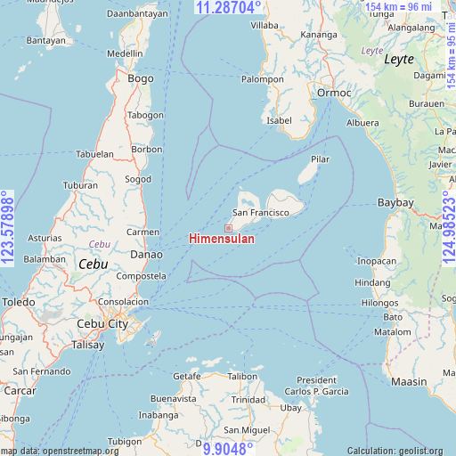
Himensulan GPS coordinates[2]
10° 35' 48.12" North, 124° 16' 55.56" East
| Map corner | latitude | longitude |
|---|---|---|
| Upper-left | 11.28704°, | 123.57898° |
| Center: | 10.5967°, | 124.2821° |
| Lower-right: | 9.9048°, | 124.98523° |
| Map W x H: | 153.7×153.7 km | = 95.5×95.5mi |
| max Lat: | 20.78733° ⇑62% North |
| Himensulan: | 10.5967° |
| min Lat: | ⇓38% South 4.65442° |
| min Long | Himensulan | max Long |
| 117.04868° | 124.2821° | 126.58417° |
| W 75.1%⇐ | ⇒24.9% E |
Elevation
Elevation of Himensulan is 20 m = 66 ft, and this is 67.9 m = 223 ft below average elevation for this country.
| Max E: |
2262 m = 7421 ft | 54.5% |
| Avg. | 87.9 m = 288 ft | |
| Himensulan | 20 m = 66 ft | |
Min E: |
-2 m = -7 ft | 45.5% |
See also: Philippines elevation on elevation.city.
Geographical zone
Himensulan is located in North Torrid zone (between Equator and Tropic of Cancer). Distance of Equator is 1178.2 km =732.1 mi to South.| Distance of | km | miles | from Himensulan |
|---|---|---|---|
| North Pole | 8828.8 | 5486 | to North |
| Arctic Circle | 6222.9 | 3866.7 | to North |
| Tropic Cancer | 1427.7 | 887.1 | to North |
| Equator | 1178.2 | 732.1 | to South |


Nearby cities:
15 places around Himensulan: (largest is in red/bold)
• Catmondaan
30.9 km =19.2 mi,  288°
288°
• Cogan
28.9 km =18 mi,  269°
269°
• Consuelo
4.7 km =2.9 mi,  25°
25°
• Danao
29.1 km =18.1 mi,  253°
253°
• Esperanza
12 km =7.5 mi,  17°
17°
• Esperanza
18.6 km =11.6 mi,  50°
50°
• Macaas
31.7 km =19.7 mi, 291°
• Mercedes
15.4 km =9.6 mi,  58°
58°
• Panalipan
29 km =18 mi,  281°
281°
• Poro
14.3 km =8.9 mi,  75°
75°
• San Francisco
12.2 km =7.6 mi, 63°
• Santa Cruz
8.7 km =5.4 mi, 45°
• Santiago
2.8 km =1.7 mi,  106°
106°
• Tudela
21.4 km =13.3 mi, 77°
• Union
9.4 km =5.8 mi, 30°
Sources, notices
• [Note1] Compared only with cities in Philippines existing in our database
• [Src1] Map data: © OpenStreetMap contributors (CC-BY-SA)
• [Src2] Other city data from geonames.org with taken over terms of usage.
• [Src3] Geographical zone / Annual Mean Temperature by Robert A. Rohde @ Wikipedia
