Rizal geodata
Rizal (Calabarzon) is a populated place; located in Philippines in Asia/Manila (GMT+8) time zone. With population of 2,796 people, there are 2795 cities with bigger population in this country. Compared to other cities in Philippines, 67% of cities are located further ↓South; 72.4% of cities are located further →East and 89.2% of cities have lower elevation than Rizal. Note1


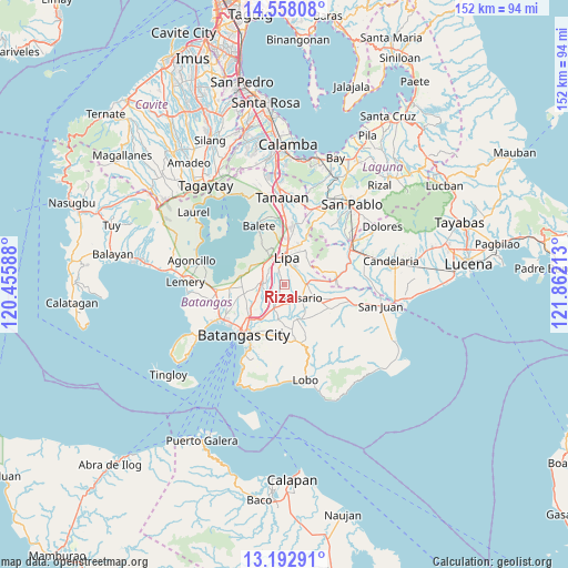
Rizal GPS coordinates[2]
13° 52' 35.4" North, 121° 9' 32.4" East
| Map corner | latitude | longitude |
|---|---|---|
| Upper-left | 14.55808°, | 120.45588° |
| Center: | 13.8765°, | 121.159° |
| Lower-right: | 13.19291°, | 121.86213° |
| Map W x H: | 151.8×151.8 km | = 94.3×94.3mi |
| max Lat: | 20.78733° ⇑33% North |
| Rizal: | 13.8765° |
| min Lat: | ⇓67% South 4.65442° |
| min Long | Rizal | max Long |
| 117.04868° | 121.159° | 126.58417° |
| W 27.6%⇐ | ⇒72.4% E |
Elevation
Elevation of Rizal is 205 m = 673 ft, and this is 117.1 m = 384 ft above average elevation for this country.
| Max E: |
2262 m = 7421 ft | 10.8% |
| Rizal | 205 m 673 ft | |
| Avg. | 87.9 m = 288 ft | |
Min E: |
-2 m = -7 ft | 89.2% |
See also: Philippines elevation on elevation.city.
Geographical zone
Rizal is located in North Torrid zone (between Equator and Tropic of Cancer). Distance of this Northern Tropic circle is 1063 km =660.5 mi to North.| Distance of | km | miles | from Rizal |
|---|---|---|---|
| North Pole | 8464.1 | 5259.3 | to North |
| Arctic Circle | 5858.3 | 3640.2 | to North |
| Tropic Cancer | 1063 | 660.5 | to North |
| Equator | 1542.9 | 958.7 | to South |


Nearby cities:
15 places around Rizal: (largest is in red/bold)
• Aya
5.3 km =3.3 mi,  292°
292°
• Banaba
5.9 km =3.7 mi,  67°
67°
• Banaybanay
5.3 km =3.3 mi,  123°
123°
• Lapolapo
5.2 km =3.2 mi,  205°
205°
• Matala
5.3 km =3.3 mi,  184°
184°
• Padre Garcia
5.9 km =3.7 mi,  87°
87°
• Pangao
5.8 km =3.6 mi,  321°
321°
• Quilo-quilo
6.8 km =4.2 mi,  101°
101°
• Rosario
6 km =3.7 mi, 124°
• San Jose
5.9 km =3.7 mi,  272°
272°
• San Miguel
4.3 km =2.7 mi, 93°
• Santa Cruz
3.5 km =2.2 mi,  111°
111°
• Santo Niño
4.2 km =2.6 mi,  222°
222°
• Talaibon
4.8 km =3 mi, 205°
• Taysan
6.7 km =4.2 mi,  263°
263°
Sources, notices
• [Note1] Compared only with cities in Philippines existing in our database
• [Src1] Map data: © OpenStreetMap contributors (CC-BY-SA)
• [Src2] Other city data from geonames.org with taken over terms of usage.
• [Src3] Geographical zone / Annual Mean Temperature by Robert A. Rohde @ Wikipedia
