Lapolapo geodata
Lapolapo (Calabarzon) is a populated place; located in Philippines in Asia/Manila (GMT+8) time zone. With population of 3,621 people, there are 1964 cities with bigger population in this country. Compared to other cities in Philippines, 66% of cities are located further ↓South; 72.7% of cities are located further →East and 85.4% of cities have lower elevation than Lapolapo. Note1


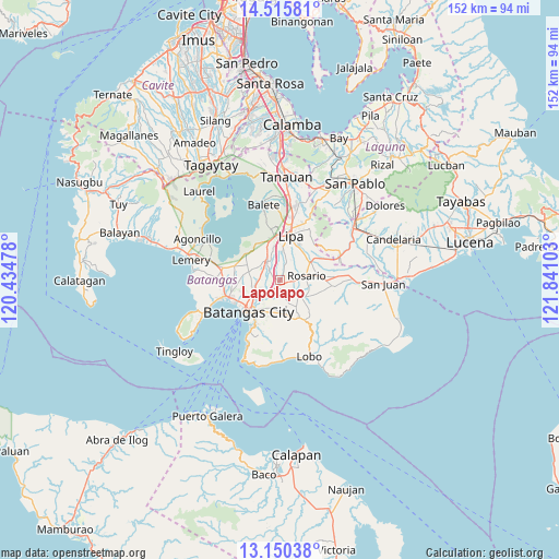
Lapolapo GPS coordinates[2]
13° 50' 2.76" North, 121° 8' 16.44" East
| Map corner | latitude | longitude |
|---|---|---|
| Upper-left | 14.51581°, | 120.43478° |
| Center: | 13.8341°, | 121.1379° |
| Lower-right: | 13.15038°, | 121.84103° |
| Map W x H: | 151.8×151.8 km | = 94.3×94.3mi |
| max Lat: | 20.78733° ⇑34% North |
| Lapolapo: | 13.8341° |
| min Lat: | ⇓66% South 4.65442° |
| min Long | Lapolapo | max Long |
| 117.04868° | 121.1379° | 126.58417° |
| W 27.3%⇐ | ⇒72.7% E |
Elevation
Elevation of Lapolapo is 145 m = 476 ft, and this is 57.1 m = 187 ft above average elevation for this country.
| Max E: |
2262 m = 7421 ft | 14.6% |
| Lapolapo | 145 m 476 ft | |
| Avg. | 87.9 m = 288 ft | |
Min E: |
-2 m = -7 ft | 85.4% |
See also: Philippines elevation on elevation.city.
Geographical zone
Lapolapo is located in North Torrid zone (between Equator and Tropic of Cancer). Distance of this Northern Tropic circle is 1067.7 km =663.4 mi to North.| Distance of | km | miles | from Lapolapo |
|---|---|---|---|
| North Pole | 8468.9 | 5262.3 | to North |
| Arctic Circle | 5863 | 3643.1 | to North |
| Tropic Cancer | 1067.7 | 663.4 | to North |
| Equator | 1538.2 | 955.8 | to South |


Nearby cities:
15 places around Lapolapo: (largest is in red/bold)
• Aya
7.2 km =4.5 mi,  338°
338°
• Balagtasin
9.2 km =5.7 mi,  324°
324°
• Banaybanay
6.9 km =4.3 mi,  75°
75°
• Bukal
4.8 km =3 mi,  273°
273°
• Ibaan
1.9 km =1.2 mi,  196°
196°
• Matala
1.9 km =1.2 mi,  108°
108°
• Rizal
5.2 km =3.2 mi,  25°
25°
• Rosario
7.3 km =4.5 mi, 80°
• San Jose
6.1 km =3.8 mi, 323°
• San Miguel
7.9 km =4.9 mi,  55°
55°
• Santa Cruz
6.5 km =4 mi, 57°
• Santo Niño
1.7 km =1.1 mi, 341°
• Talaibon
0.5 km =0.3 mi, 26°
• Taysan
5.9 km =3.7 mi,  311°
311°
• Taysan
6.9 km =4.3 mi,  126°
126°
Sources, notices
• [Note1] Compared only with cities in Philippines existing in our database
• [Src1] Map data: © OpenStreetMap contributors (CC-BY-SA)
• [Src2] Other city data from geonames.org with taken over terms of usage.
• [Src3] Geographical zone / Annual Mean Temperature by Robert A. Rohde @ Wikipedia
