President Roxas geodata
President Roxas (Western Visayas) is a seat of a third-order administrative division; located in Philippines in Asia/Manila (GMT+8) time zone. With population of 7,240 people, there are 865 cities with bigger population in this country. Compared to other cities in Philippines, 52.2% of cities are located further ↑North; 52% of cities are located further ←West and 85.4% of cities have higher elevation than President Roxas. Note1
Administrative division(s):
- Level 1: Western Visayas
- Level 2: Province of Capiz
- Level 3: President Roxas


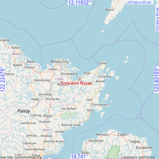
President Roxas GPS coordinates[2]
11° 25' 51.6" North, 122° 55' 40.44" East
| Map corner | latitude | longitude |
|---|---|---|
| Upper-left | 12.11932°, | 122.22478° |
| Center: | 11.431°, | 122.9279° |
| Lower-right: | 10.741°, | 123.63103° |
| Map W x H: | 153.3×153.3 km | = 95.3×95.3mi |
| max Lat: | 20.78733° ⇑52.2% North |
| President Roxas: | 11.431° |
| min Lat: | ⇓47.8% South 4.65442° |
| min Long | President Roxas | max Long |
| 117.04868° | 122.9279° | 126.58417° |
| W 52%⇐ | ⇒48% E |
Elevation
Elevation of President Roxas is 8 m = 26 ft, and this is 79.9 m = 262 ft below average elevation for this country.
| Max E: |
2262 m = 7421 ft | 85.4% |
| Avg. | 87.9 m = 288 ft | |
| President Roxas | 8 m = 26 ft | |
Min E: |
-2 m = -7 ft | 14.6% |
See also: Philippines elevation on elevation.city.
Geographical zone
President Roxas is located in North Torrid zone (between Equator and Tropic of Cancer). Distance of Equator is 1271 km =789.8 mi to South.| Distance of | km | miles | from President Roxas |
|---|---|---|---|
| North Pole | 8736.1 | 5428.4 | to North |
| Arctic Circle | 6130.2 | 3809.1 | to North |
| Tropic Cancer | 1334.9 | 829.5 | to North |
| Equator | 1271 | 789.8 | to South |


Nearby cities:
15 places around President Roxas: (largest is in red/bold)
• Bailan
11.1 km =6.9 mi,  285°
285°
• Balasan
18 km =11.2 mi,  75°
75°
• Binantocan
7.8 km =4.8 mi,  250°
250°
• Cassanayan
16.5 km =10.3 mi,  54°
54°
• Cogon
14.1 km =8.8 mi, 285°
• Dulangan
4.1 km =2.5 mi, 47°
• Hipona
5.2 km =3.2 mi, 253°
• Lantangan
6.6 km =4.1 mi,  220°
220°
• Maayon
16.2 km =10.1 mi, 252°
• Panitan
17.4 km =10.8 mi,  282°
282°
• Pilar
9.7 km =6 mi, 50°
• Pontevedra
11.8 km =7.3 mi,  298°
298°
• Quipot
18.2 km =11.3 mi,  154°
154°
• Rizal
7.5 km =4.7 mi, 282°
• Tabuc Pontevedra
13.4 km =8.3 mi, 295°
Sources, notices
• [Note1] Compared only with cities in Philippines existing in our database
• [Src1] Map data: © OpenStreetMap contributors (CC-BY-SA)
• [Src2] Other city data from geonames.org with taken over terms of usage.
• [Src3] Geographical zone / Annual Mean Temperature by Robert A. Rohde @ Wikipedia
