Pangdan geodata
Pangdan (Central Visayas) is a populated place; located in Philippines in Asia/Manila (GMT+8) time zone. With population of 4,063 people, there are 1686 cities with bigger population in this country. Compared to other cities in Philippines, 66.1% of cities are located further ↑North; 66.5% of cities are located further ←West and 76.6% of cities have lower elevation than Pangdan. Note1
Administrative division(s):
- Level 1: Central Visayas
- Level 2: Province of Cebu
- Level 3: City of Naga


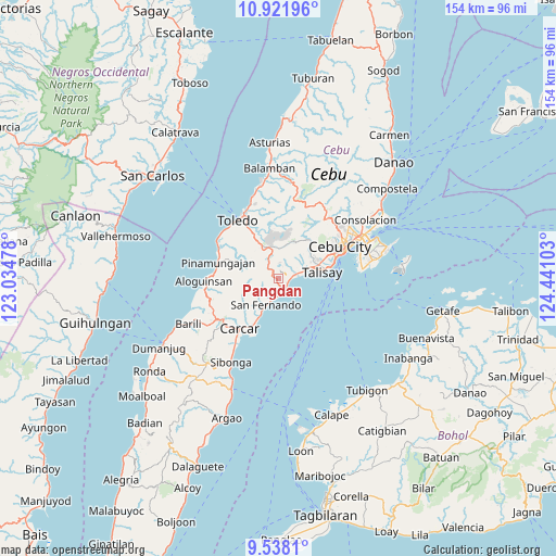
Pangdan GPS coordinates[2]
10° 13' 50.808" North, 123° 44' 16.44" East
| Map corner | latitude | longitude |
|---|---|---|
| Upper-left | 10.92196°, | 123.03478° |
| Center: | 10.23078°, | 123.7379° |
| Lower-right: | 9.5381°, | 124.44103° |
| Map W x H: | 153.9×153.9 km | = 95.6×95.6mi |
| max Lat: | 20.78733° ⇑66.1% North |
| Pangdan: | 10.23078° |
| min Lat: | ⇓33.9% South 4.65442° |
| min Long | Pangdan | max Long |
| 117.04868° | 123.7379° | 126.58417° |
| W 66.5%⇐ | ⇒33.5% E |
Elevation
Elevation of Pangdan is 74 m = 243 ft, and this is 13.9 m = 46 ft below average elevation for this country.
| Max E: |
2262 m = 7421 ft | 23.4% |
| Avg. | 87.9 m = 288 ft | |
| Pangdan | 74 m = 243 ft | |
Min E: |
-2 m = -7 ft | 76.6% |
See also: Philippines elevation on elevation.city.
Geographical zone
Pangdan is located in North Torrid zone (between Equator and Tropic of Cancer). Distance of Equator is 1137.6 km =706.9 mi to South.| Distance of | km | miles | from Pangdan |
|---|---|---|---|
| North Pole | 8869.5 | 5511.3 | to North |
| Arctic Circle | 6263.6 | 3892 | to North |
| Tropic Cancer | 1468.4 | 912.4 | to North |
| Equator | 1137.6 | 706.9 | to South |


Nearby cities:
15 places around Pangdan: (largest is in red/bold)
• Alpaco
6.2 km =3.9 mi,  283°
283°
• Bairan
3.9 km =2.4 mi,  197°
197°
• Balud
10.4 km =6.5 mi,  206°
206°
• Cantao-an
1.8 km =1.1 mi,  44°
44°
• Cogon
4.7 km =2.9 mi,  28°
28°
• Guindarohan
4.5 km =2.8 mi, 41°
• Inayagan
3.4 km =2.1 mi,  82°
82°
• Jaclupan
11.6 km =7.2 mi,  47°
47°
• Kuanos
7.4 km =4.6 mi, 38°
• Lanas
4 km =2.5 mi,  352°
352°
• Langtad
5 km =3.1 mi,  184°
184°
• Minglanilla
6.6 km =4.1 mi, 76°
• Naga
3.3 km =2.1 mi,  137°
137°
• San Fernando
8.3 km =5.2 mi, 203°
• Uling
6.3 km =3.9 mi,  331°
331°
Sources, notices
• [Note1] Compared only with cities in Philippines existing in our database
• [Src1] Map data: © OpenStreetMap contributors (CC-BY-SA)
• [Src2] Other city data from geonames.org with taken over terms of usage.
• [Src3] Geographical zone / Annual Mean Temperature by Robert A. Rohde @ Wikipedia
