Jaclupan geodata
Jaclupan (Central Visayas) is a populated place; located in Philippines in Asia/Manila (GMT+8) time zone. With population of 9,652 people, there are 639 cities with bigger population in this country. Compared to other cities in Philippines, 65.1% of cities are located further ↑North; 68.1% of cities are located further ←West and 71.2% of cities have lower elevation than Jaclupan. Note1
Administrative division(s):
- Level 1: Central Visayas
- Level 2: Province of Cebu
- Level 3: City of Talisay


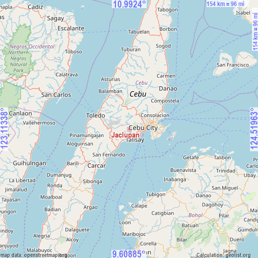
Jaclupan GPS coordinates[2]
10° 18' 4.968" North, 123° 48' 59.4" East
| Map corner | latitude | longitude |
|---|---|---|
| Upper-left | 10.9924°, | 123.11338° |
| Center: | 10.30138°, | 123.8165° |
| Lower-right: | 9.60885°, | 124.51963° |
| Map W x H: | 153.8×153.8 km | = 95.6×95.6mi |
| max Lat: | 20.78733° ⇑65.1% North |
| Jaclupan: | 10.30138° |
| min Lat: | ⇓34.9% South 4.65442° |
| min Long | Jaclupan | max Long |
| 117.04868° | 123.8165° | 126.58417° |
| W 68.1%⇐ | ⇒31.9% E |
Elevation
Elevation of Jaclupan is 55 m = 180 ft, and this is 32.9 m = 108 ft below average elevation for this country.
| Max E: |
2262 m = 7421 ft | 28.8% |
| Avg. | 87.9 m = 288 ft | |
| Jaclupan | 55 m = 180 ft | |
Min E: |
-2 m = -7 ft | 71.2% |
See also: Philippines elevation on elevation.city.
Geographical zone
Jaclupan is located in North Torrid zone (between Equator and Tropic of Cancer). Distance of Equator is 1145.4 km =711.7 mi to South.| Distance of | km | miles | from Jaclupan |
|---|---|---|---|
| North Pole | 8861.7 | 5506.4 | to North |
| Arctic Circle | 6255.8 | 3887.2 | to North |
| Tropic Cancer | 1460.5 | 907.5 | to North |
| Equator | 1145.4 | 711.7 | to South |


Nearby cities:
15 places around Jaclupan: (largest is in red/bold)
• Adlaon
9.1 km =5.7 mi,  90°
90°
• Apas
10.4 km =6.5 mi,  65°
65°
• Baugo
11.4 km =7.1 mi,  80°
80°
• Cantao-an
9.8 km =6.1 mi,  228°
228°
• Cebu City
8.3 km =5.2 mi, 78°
• Cogon
7.4 km =4.6 mi,  239°
239°
• Guindarohan
7.1 km =4.4 mi, 231°
• Inayagan
9 km =5.6 mi,  215°
215°
• Kuanos
4.5 km =2.8 mi, 242°
• Lanas
9.9 km =6.2 mi,  247°
247°
• Mandaue City
11.8 km =7.3 mi, 77°
• Minglanilla
6.6 km =4.1 mi,  199°
199°
• Pangdan
11.6 km =7.2 mi, 227°
• Talisay
7.3 km =4.5 mi,  150°
150°
• Tangke
7.4 km =4.6 mi,  134°
134°
Sources, notices
• [Note1] Compared only with cities in Philippines existing in our database
• [Src1] Map data: © OpenStreetMap contributors (CC-BY-SA)
• [Src2] Other city data from geonames.org with taken over terms of usage.
• [Src3] Geographical zone / Annual Mean Temperature by Robert A. Rohde @ Wikipedia
