Minglanilla geodata
Minglanilla (Central Visayas) is a seat of a third-order administrative division; located in Philippines in Asia/Manila (GMT+8) time zone. With population of 62,058 people, there are 152 cities with bigger population in this country. Compared to other cities in Philippines, 65.8% of cities are located further ↑North; 67.9% of cities are located further ←West and 60.8% of cities have higher elevation than Minglanilla. Note1


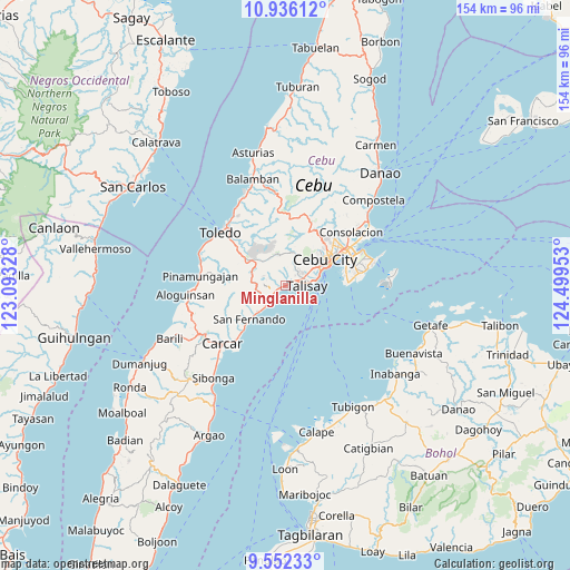
Minglanilla GPS coordinates[2]
10° 14' 41.928" North, 123° 47' 47.04" East
| Map corner | latitude | longitude |
|---|---|---|
| Upper-left | 10.93612°, | 123.09328° |
| Center: | 10.24498°, | 123.7964° |
| Lower-right: | 9.55233°, | 124.49953° |
| Map W x H: | 153.9×153.9 km | = 95.6×95.6mi |
| max Lat: | 20.78733° ⇑65.8% North |
| Minglanilla: | 10.24498° |
| min Lat: | ⇓34.2% South 4.65442° |
| min Long | Minglanilla | max Long |
| 117.04868° | 123.7964° | 126.58417° |
| W 67.9%⇐ | ⇒32.1% E |
Elevation
Elevation of Minglanilla is 16 m = 52 ft, and this is 71.9 m = 236 ft below average elevation for this country.
| Max E: |
2262 m = 7421 ft | 60.8% |
| Avg. | 87.9 m = 288 ft | |
| Minglanilla | 16 m = 52 ft | |
Min E: |
-2 m = -7 ft | 39.2% |
See also: Minglanilla elevation on elevation.city.
Geographical zone
Minglanilla is located in North Torrid zone (between Equator and Tropic of Cancer). Distance of Equator is 1139.1 km =707.8 mi to South.| Distance of | km | miles | from Minglanilla |
|---|---|---|---|
| North Pole | 8867.9 | 5510.3 | to North |
| Arctic Circle | 6262 | 3891 | to North |
| Tropic Cancer | 1466.8 | 911.4 | to North |
| Equator | 1139.1 | 707.8 | to South |


Nearby cities:
15 places around Minglanilla: (largest is in red/bold)
• Alpaco
12.5 km =7.8 mi,  269°
269°
• Bairan
9.3 km =5.8 mi,  234°
234°
• Cantao-an
5.1 km =3.2 mi, 267°
• Cogon
4.9 km =3 mi,  301°
301°
• Guindarohan
3.8 km =2.4 mi, 297°
• Inayagan
3.2 km =2 mi,  249°
249°
• Jaclupan
6.6 km =4.1 mi,  19°
19°
• Kuanos
4.6 km =2.9 mi,  336°
336°
• Lanas
7.3 km =4.5 mi,  289°
289°
• Langtad
9.5 km =5.9 mi, 225°
• Naga
5.8 km =3.6 mi, 226°
• Pangdan
6.6 km =4.1 mi,  256°
256°
• Talisay
5.8 km =3.6 mi,  90°
90°
• Tangke
7.6 km =4.7 mi,  81°
81°
• Uling
10.2 km =6.3 mi, 292°
Sources, notices
• [Note1] Compared only with cities in Philippines existing in our database
• [Src1] Map data: © OpenStreetMap contributors (CC-BY-SA)
• [Src2] Other city data from geonames.org with taken over terms of usage.
• [Src3] Geographical zone / Annual Mean Temperature by Robert A. Rohde @ Wikipedia
