Panan geodata
Panan (Central Luzon) is a populated place; located in Philippines in Asia/Manila (GMT+8) time zone. With population of 2,294 people, there are 3698 cities with bigger population in this country. Compared to other cities in Philippines, 79.3% of cities are located further ↓South; 96.9% of cities are located further →East and 65.1% of cities have higher elevation than Panan. Note1


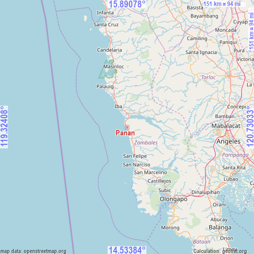
Panan GPS coordinates[2]
15° 12' 48.24" North, 120° 1' 37.92" East
| Map corner | latitude | longitude |
|---|---|---|
| Upper-left | 15.89078°, | 119.32408° |
| Center: | 15.2134°, | 120.0272° |
| Lower-right: | 14.53384°, | 120.73033° |
| Map W x H: | 150.9×150.9 km | = 93.8×93.8mi |
| max Lat: | 20.78733° ⇑20.7% North |
| Panan: | 15.2134° |
| min Lat: | ⇓79.3% South 4.65442° |
| min Long | Panan | max Long |
| 117.04868° | 120.0272° | 126.58417° |
| W 3.1%⇐ | ⇒96.9% E |
Elevation
Elevation of Panan is 14 m = 46 ft, and this is 73.9 m = 242 ft below average elevation for this country.
| Max E: |
2262 m = 7421 ft | 65.1% |
| Avg. | 87.9 m = 288 ft | |
| Panan | 14 m = 46 ft | |
Min E: |
-2 m = -7 ft | 34.9% |
See also: Philippines elevation on elevation.city.
Geographical zone
Panan is located in North Torrid zone (between Equator and Tropic of Cancer). Distance of this Northern Tropic circle is 914.3 km =568.1 mi to North.| Distance of | km | miles | from Panan |
|---|---|---|---|
| North Pole | 8315.5 | 5167 | to North |
| Arctic Circle | 5709.6 | 3547.8 | to North |
| Tropic Cancer | 914.3 | 568.1 | to North |
| Equator | 1691.6 | 1051.1 | to South |


Nearby cities:
15 places around Panan: (largest is in red/bold)
• Amuñgan
18.4 km =11.4 mi,  336°
336°
• Beddeng
27 km =16.8 mi,  166°
166°
• Botolan
8.5 km =5.3 mi,  358°
358°
• Bulawin
23.9 km =14.9 mi, 341°
• Cabangan
6.9 km =4.3 mi,  152°
152°
• Iba
13.8 km =8.6 mi, 337°
• Liozon
23 km =14.3 mi,  333°
333°
• Maloma
11.8 km =7.3 mi,  160°
160°
• Mambog
11.2 km =7 mi,  1°
1°
• Palauig
27.9 km =17.3 mi, 331°
• Poblacion, San Felipe
17.4 km =10.8 mi, 164°
• Purac
4.4 km =2.7 mi,  345°
345°
• Salaza
27.9 km =17.3 mi, 343°
• San Juan
9.4 km =5.8 mi,  25°
25°
• San Narciso
22.9 km =14.2 mi, 165°
Sources, notices
• [Note1] Compared only with cities in Philippines existing in our database
• [Src1] Map data: © OpenStreetMap contributors (CC-BY-SA)
• [Src2] Other city data from geonames.org with taken over terms of usage.
• [Src3] Geographical zone / Annual Mean Temperature by Robert A. Rohde @ Wikipedia
