Beddeng geodata
Beddeng (Central Luzon) is a populated place; located in Philippines in Asia/Manila (GMT+8) time zone. With population of 2,565 people, there are 3176 cities with bigger population in this country. Compared to other cities in Philippines, 77.3% of cities are located further ↓South; 96.6% of cities are located further →East and 60.8% of cities have higher elevation than Beddeng. Note1
Administrative division(s):
- Level 1: Central Luzon
- Level 2: Province of Zambales
- Level 3: San Narciso


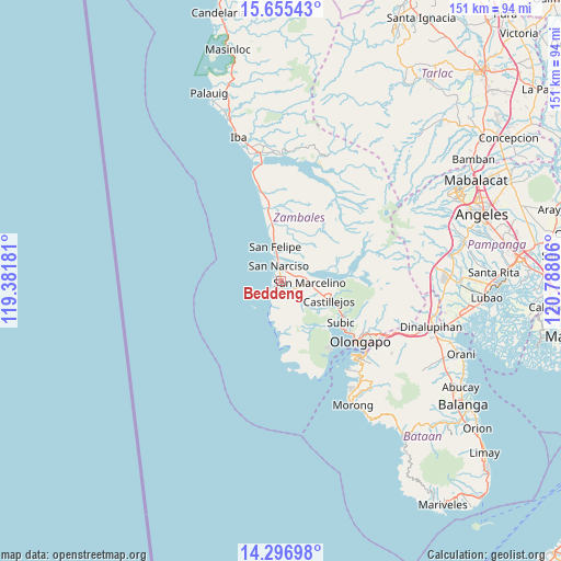
Beddeng GPS coordinates[2]
14° 58' 38.208" North, 120° 5' 5.748" East
| Map corner | latitude | longitude |
|---|---|---|
| Upper-left | 15.65543°, | 119.38181° |
| Center: | 14.97728°, | 120.08493° |
| Lower-right: | 14.29698°, | 120.78806° |
| Map W x H: | 151×151 km | = 93.8×93.8mi |
| max Lat: | 20.78733° ⇑22.7% North |
| Beddeng: | 14.97728° |
| min Lat: | ⇓77.3% South 4.65442° |
| min Long | Beddeng | max Long |
| 117.04868° | 120.08493° | 126.58417° |
| W 3.4%⇐ | ⇒96.6% E |
Elevation
Elevation of Beddeng is 16 m = 52 ft, and this is 71.9 m = 236 ft below average elevation for this country.
| Max E: |
2262 m = 7421 ft | 60.8% |
| Avg. | 87.9 m = 288 ft | |
| Beddeng | 16 m = 52 ft | |
Min E: |
-2 m = -7 ft | 39.2% |
See also: Philippines elevation on elevation.city.
Geographical zone
Beddeng is located in North Torrid zone (between Equator and Tropic of Cancer). Distance of this Northern Tropic circle is 940.6 km =584.5 mi to North.| Distance of | km | miles | from Beddeng |
|---|---|---|---|
| North Pole | 8341.7 | 5183.3 | to North |
| Arctic Circle | 5735.9 | 3564.1 | to North |
| Tropic Cancer | 940.6 | 584.5 | to North |
| Equator | 1665.3 | 1034.8 | to South |


Nearby cities:
15 places around Beddeng: (largest is in red/bold)
• Cabangan
20.3 km =12.6 mi,  351°
351°
• Castillejos
13.1 km =8.1 mi,  111°
111°
• Maloma
15.3 km =9.5 mi, 351°
• Olongapo
26.9 km =16.7 mi,  127°
127°
• Pamatawan
14.9 km =9.3 mi, 111°
• Panan
27 km =16.8 mi, 346°
• Poblacion, San Felipe
9.6 km =6 mi, 350°
• San Agustin
8.5 km =5.3 mi,  124°
124°
• San Antonio
3.4 km =2.1 mi,  176°
176°
• San Marcelino
7.8 km =4.8 mi,  92°
92°
• San Narciso
4.1 km =2.5 mi, 353°
• San Nicolas
3.2 km =2 mi,  195°
195°
• Santa Fe
13.9 km =8.6 mi,  74°
74°
• Subic
19.2 km =11.9 mi, 124°
• Subic Bay Freeport Zone
29.6 km =18.4 mi, 134°
Sources, notices
• [Note1] Compared only with cities in Philippines existing in our database
• [Src1] Map data: © OpenStreetMap contributors (CC-BY-SA)
• [Src2] Other city data from geonames.org with taken over terms of usage.
• [Src3] Geographical zone / Annual Mean Temperature by Robert A. Rohde @ Wikipedia
