Palagao Norte geodata
Palagao Norte (Cagayan Valley) is a populated place; located in Philippines in Asia/Manila (GMT+8) time zone. With population of 2,953 people, there are 2584 cities with bigger population in this country. Compared to other cities in Philippines, 98.3% of cities are located further ↓South; 63.8% of cities are located further →East and 57.6% of cities have higher elevation than Palagao Norte. Note1


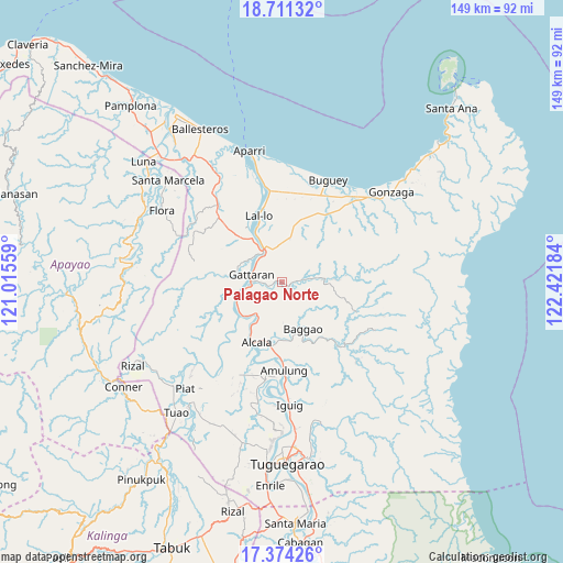
Palagao Norte GPS coordinates[2]
18° 2' 38.616" North, 121° 43' 7.356" East
| Map corner | latitude | longitude |
|---|---|---|
| Upper-left | 18.71132°, | 121.01559° |
| Center: | 18.04406°, | 121.71871° |
| Lower-right: | 17.37426°, | 122.42184° |
| Map W x H: | 148.7×148.7 km | = 92.4×92.4mi |
| max Lat: | 20.78733° ⇑1.7% North |
| Palagao Norte: | 18.04406° |
| min Lat: | ⇓98.3% South 4.65442° |
| min Long | Palagao Norte | max Long |
| 117.04868° | 121.71871° | 126.58417° |
| W 36.2%⇐ | ⇒63.8% E |
Elevation
Elevation of Palagao Norte is 18 m = 59 ft, and this is 69.9 m = 229 ft below average elevation for this country.
| Max E: |
2262 m = 7421 ft | 57.6% |
| Avg. | 87.9 m = 288 ft | |
| Palagao Norte | 18 m = 59 ft | |
Min E: |
-2 m = -7 ft | 42.4% |
See also: Philippines elevation on elevation.city.
Geographical zone
Palagao Norte is located in North Torrid zone (between Equator and Tropic of Cancer). Distance of this Northern Tropic circle is 599.6 km =372.6 mi to North.| Distance of | km | miles | from Palagao Norte |
|---|---|---|---|
| North Pole | 8000.8 | 4971.5 | to North |
| Arctic Circle | 5394.9 | 3352.2 | to North |
| Tropic Cancer | 599.6 | 372.6 | to North |
| Equator | 2006.3 | 1246.7 | to South |


Nearby cities:
15 places around Palagao Norte: (largest is in red/bold)
• Alannay
14.1 km =8.8 mi,  277°
277°
• Alcala
17.1 km =10.6 mi,  202°
202°
• Bagumbayan
17.7 km =11 mi,  340°
340°
• Calantac
15 km =9.3 mi,  178°
178°
• Calaoagan
0.5 km =0.3 mi,  106°
106°
• Capissayan Sur
10.5 km =6.5 mi,  85°
85°
• Catayauan
14.7 km =9.1 mi,  331°
331°
• Dalaoig
10.6 km =6.6 mi, 182°
• Gattaran
8.1 km =5 mi, 283°
• Lasam
12.7 km =7.9 mi, 280°
• Magapit
11.6 km =7.2 mi, 333°
• Magapit, Aguiguican
8.4 km =5.2 mi, 328°
• Santa Maria
12.2 km =7.6 mi, 332°
• Taguing
11.5 km =7.1 mi,  160°
160°
• Tupang
17.5 km =10.9 mi,  207°
207°
Sources, notices
• [Note1] Compared only with cities in Philippines existing in our database
• [Src1] Map data: © OpenStreetMap contributors (CC-BY-SA)
• [Src2] Other city data from geonames.org with taken over terms of usage.
• [Src3] Geographical zone / Annual Mean Temperature by Robert A. Rohde @ Wikipedia
