Balabagan geodata
Balabagan (Autonomous Region in Muslim Mindanao) is a seat of a third-order administrative division; located in Philippines in Asia/Manila (GMT+8) time zone. With population of 2,423 people, there are 3424 cities with bigger population in this country. Compared to other cities in Philippines, 86.7% of cities are located further ↑North; 73% of cities are located further ←West and 76.6% of cities have higher elevation than Balabagan. Note1
Administrative division(s):
- Level 1: Autonomous Region in Muslim Mindanao
- Level 2: Province of Lanao del Sur
- Level 3: Balabagan


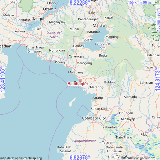
Balabagan GPS coordinates[2]
7° 31' 35.004" North, 124° 6' 51.012" East
| Map corner | latitude | longitude |
|---|---|---|
| Upper-left | 8.22288°, | 123.41105° |
| Center: | 7.52639°, | 124.11417° |
| Lower-right: | 6.82878°, | 124.8173° |
| Map W x H: | 155×155 km | = 96.3×96.3mi |
| max Lat: | 20.78733° ⇑86.7% North |
| Balabagan: | 7.52639° |
| min Lat: | ⇓13.3% South 4.65442° |
| min Long | Balabagan | max Long |
| 117.04868° | 124.11417° | 126.58417° |
| W 73%⇐ | ⇒27% E |
Elevation
Elevation of Balabagan is 10 m = 33 ft, and this is 77.9 m = 256 ft below average elevation for this country.
| Max E: |
2262 m = 7421 ft | 76.6% |
| Avg. | 87.9 m = 288 ft | |
| Balabagan | 10 m = 33 ft | |
Min E: |
-2 m = -7 ft | 23.4% |
See also: Philippines elevation on elevation.city.
Geographical zone
Balabagan is located in North Torrid zone (between Equator and Tropic of Cancer). Distance of Equator is 836.9 km =520 mi to South.| Distance of | km | miles | from Balabagan |
|---|---|---|---|
| North Pole | 9170.2 | 5698.1 | to North |
| Arctic Circle | 6564.3 | 4078.9 | to North |
| Tropic Cancer | 1769.1 | 1099.3 | to North |
| Equator | 836.9 | 520 | to South |


Nearby cities:
15 places around Balabagan: (largest is in red/bold)
• Barira
20.9 km =13 mi,  102°
102°
• Bayanga
15.2 km =9.4 mi,  92°
92°
• Bualan
19 km =11.8 mi,  117°
117°
• Bugasan
18.6 km =11.6 mi, 120°
• Calanogas
24.9 km =15.5 mi,  356°
356°
• Katuli
15.3 km =9.5 mi,  132°
132°
• Litayan
22.9 km =14.2 mi,  202°
202°
• Malabang
8.6 km =5.3 mi,  325°
325°
• Marogong
16.1 km =10 mi,  14°
14°
• Matanog
15.7 km =9.8 mi, 94°
• Parang
24.4 km =15.2 mi,  135°
135°
• Polloc
22.5 km =14 mi,  148°
148°
• Rominimbang
20.7 km =12.9 mi, 98°
• Sapadun
15.7 km =9.8 mi,  107°
107°
• Tubaran
27.3 km =17 mi, 12°
Sources, notices
• [Note1] Compared only with cities in Philippines existing in our database
• [Src1] Map data: © OpenStreetMap contributors (CC-BY-SA)
• [Src2] Other city data from geonames.org with taken over terms of usage.
• [Src3] Geographical zone / Annual Mean Temperature by Robert A. Rohde @ Wikipedia
