Mapolopolo geodata
Mapolopolo (Ilocos) is a populated place; located in Philippines in Asia/Manila (GMT+8) time zone. With population of 2,219 people, there are 3849 cities with bigger population in this country. Compared to other cities in Philippines, 85.8% of cities are located further ↓South; 94.4% of cities are located further →East and 65.1% of cities have higher elevation than Mapolopolo. Note1


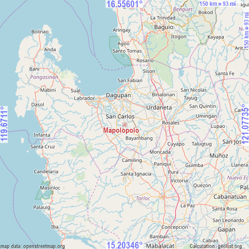
Mapolopolo GPS coordinates[2]
15° 52' 51.132" North, 120° 22' 27.192" East
| Map corner | latitude | longitude |
|---|---|---|
| Upper-left | 16.55601°, | 119.6711° |
| Center: | 15.88087°, | 120.37422° |
| Lower-right: | 15.20346°, | 121.07735° |
| Map W x H: | 150.4×150.4 km | = 93.5×93.5mi |
| max Lat: | 20.78733° ⇑14.2% North |
| Mapolopolo: | 15.88087° |
| min Lat: | ⇓85.8% South 4.65442° |
| min Long | Mapolopolo | max Long |
| 117.04868° | 120.37422° | 126.58417° |
| W 5.6%⇐ | ⇒94.4% E |
Elevation
Elevation of Mapolopolo is 14 m = 46 ft, and this is 73.9 m = 242 ft below average elevation for this country.
| Max E: |
2262 m = 7421 ft | 65.1% |
| Avg. | 87.9 m = 288 ft | |
| Mapolopolo | 14 m = 46 ft | |
Min E: |
-2 m = -7 ft | 34.9% |
See also: Philippines elevation on elevation.city.
Geographical zone
Mapolopolo is located in North Torrid zone (between Equator and Tropic of Cancer). Distance of this Northern Tropic circle is 840.1 km =522 mi to North.| Distance of | km | miles | from Mapolopolo |
|---|---|---|---|
| North Pole | 8241.3 | 5120.9 | to North |
| Arctic Circle | 5635.4 | 3501.7 | to North |
| Tropic Cancer | 840.1 | 522 | to North |
| Equator | 1765.8 | 1097.2 | to South |


Nearby cities:
15 places around Mapolopolo: (largest is in red/bold)
• Anambongan
2.2 km =1.4 mi,  136°
136°
• Bacnar
3.3 km =2.1 mi,  280°
280°
• Basista
4 km =2.5 mi, 141°
• Botao
6 km =3.7 mi,  48°
48°
• Don Pedro
6 km =3.7 mi,  85°
85°
• Dumpay
1.6 km =1 mi,  81°
81°
• Isla
7.9 km =4.9 mi, 281°
• Libas
6.2 km =3.9 mi,  266°
266°
• Malasiqui
6.1 km =3.8 mi,  44°
44°
• Malibong East
6.3 km =3.9 mi,  233°
233°
• Navatat
3.9 km =2.4 mi,  153°
153°
• Pasibi West
2.5 km =1.6 mi,  167°
167°
• Polong Norte
5.6 km =3.5 mi,  64°
64°
• Taloy
5.4 km =3.4 mi,  26°
26°
• Urbiztondo
8 km =5 mi,  216°
216°
Sources, notices
• [Note1] Compared only with cities in Philippines existing in our database
• [Src1] Map data: © OpenStreetMap contributors (CC-BY-SA)
• [Src2] Other city data from geonames.org with taken over terms of usage.
• [Src3] Geographical zone / Annual Mean Temperature by Robert A. Rohde @ Wikipedia
