Polong Norte geodata
Polong Norte (Ilocos) is a populated place; located in Philippines in Asia/Manila (GMT+8) time zone. With population of 3,063 people, there are 2456 cities with bigger population in this country. Compared to other cities in Philippines, 86.1% of cities are located further ↓South; 93.2% of cities are located further →East and 59.2% of cities have higher elevation than Polong Norte. Note1


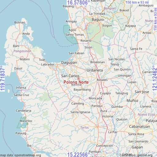
Polong Norte GPS coordinates[2]
15° 54' 10.8" North, 120° 25' 17.364" East
| Map corner | latitude | longitude |
|---|---|---|
| Upper-left | 16.57806°, | 119.71837° |
| Center: | 15.903°, | 120.42149° |
| Lower-right: | 15.22566°, | 121.12462° |
| Map W x H: | 150.4×150.4 km | = 93.5×93.5mi |
| max Lat: | 20.78733° ⇑13.9% North |
| Polong Norte: | 15.903° |
| min Lat: | ⇓86.1% South 4.65442° |
| min Long | Polong Norte | max Long |
| 117.04868° | 120.42149° | 126.58417° |
| W 6.8%⇐ | ⇒93.2% E |
Elevation
Elevation of Polong Norte is 17 m = 56 ft, and this is 70.9 m = 233 ft below average elevation for this country.
| Max E: |
2262 m = 7421 ft | 59.2% |
| Avg. | 87.9 m = 288 ft | |
| Polong Norte | 17 m = 56 ft | |
Min E: |
-2 m = -7 ft | 40.8% |
See also: Philippines elevation on elevation.city.
Geographical zone
Polong Norte is located in North Torrid zone (between Equator and Tropic of Cancer). Distance of this Northern Tropic circle is 837.7 km =520.5 mi to North.| Distance of | km | miles | from Polong Norte |
|---|---|---|---|
| North Pole | 8238.8 | 5119.4 | to North |
| Arctic Circle | 5632.9 | 3500.1 | to North |
| Tropic Cancer | 837.7 | 520.5 | to North |
| Equator | 1768.2 | 1098.7 | to South |


Nearby cities:
15 places around Polong Norte: (largest is in red/bold)
• Anambongan
5.4 km =3.4 mi,  220°
220°
• Bacundao Weste
6.1 km =3.8 mi,  76°
76°
• Balingueo
6.3 km =3.9 mi,  348°
348°
• Basista
6.2 km =3.9 mi,  204°
204°
• Bolaoit
3.4 km =2.1 mi,  16°
16°
• Botao
1.6 km =1 mi,  341°
341°
• Canan Norte
6.1 km =3.8 mi, 82°
• Don Pedro
2.2 km =1.4 mi,  154°
154°
• Dumpay
4.1 km =2.5 mi,  237°
237°
• Lepa
3.8 km =2.4 mi,  123°
123°
• Loqueb Este
5.3 km =3.3 mi,  29°
29°
• Malasiqui
2.1 km =1.3 mi, 337°
• Mapolopolo
5.6 km =3.5 mi, 244°
• Talospatang
2.6 km =1.6 mi,  53°
53°
• Taloy
3.6 km =2.2 mi,  311°
311°
Sources, notices
• [Note1] Compared only with cities in Philippines existing in our database
• [Src1] Map data: © OpenStreetMap contributors (CC-BY-SA)
• [Src2] Other city data from geonames.org with taken over terms of usage.
• [Src3] Geographical zone / Annual Mean Temperature by Robert A. Rohde @ Wikipedia
