Malayal geodata
Malayal (Zamboanga Peninsula) is a populated place; located in Philippines in Asia/Manila (GMT+8) time zone. With population of 2,811 people, there are 2776 cities with bigger population in this country. Compared to other cities in Philippines, 89.4% of cities are located further ↑North; 61% of cities are located further →East and 60.8% of cities have higher elevation than Malayal. Note1
Administrative division(s):
- Level 1: Zamboanga Peninsula
- Level 2: Province of Zamboanga del Norte
- Level 3: Sibuco


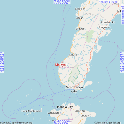
Malayal GPS coordinates[2]
7° 12' 28.836" North, 121° 56' 31.344" East
| Map corner | latitude | longitude |
|---|---|---|
| Upper-left | 7.90502°, | 121.23892° |
| Center: | 7.20801°, | 121.94204° |
| Lower-right: | 6.50992°, | 122.64517° |
| Map W x H: | 155.1×155.1 km | = 96.4×96.4mi |
| max Lat: | 20.78733° ⇑89.4% North |
| Malayal: | 7.20801° |
| min Lat: | ⇓10.6% South 4.65442° |
| min Long | Malayal | max Long |
| 117.04868° | 121.94204° | 126.58417° |
| W 39%⇐ | ⇒61% E |
Elevation
Elevation of Malayal is 16 m = 52 ft, and this is 71.9 m = 236 ft below average elevation for this country.
| Max E: |
2262 m = 7421 ft | 60.8% |
| Avg. | 87.9 m = 288 ft | |
| Malayal | 16 m = 52 ft | |
Min E: |
-2 m = -7 ft | 39.2% |
See also: Philippines elevation on elevation.city.
Geographical zone
Malayal is located in North Torrid zone (between Equator and Tropic of Cancer). Distance of Equator is 801.5 km =498 mi to South.| Distance of | km | miles | from Malayal |
|---|---|---|---|
| North Pole | 9205.6 | 5720.1 | to North |
| Arctic Circle | 6599.7 | 4100.9 | to North |
| Tropic Cancer | 1804.5 | 1121.3 | to North |
| Equator | 801.5 | 498 | to South |


Nearby cities:
15 places around Malayal: (largest is in red/bold)
• Bunguiao
30.3 km =18.8 mi,  112°
112°
• Calabasa
32.5 km =20.2 mi,  82°
82°
• Curuan
32.1 km =19.9 mi,  90°
90°
• Dulian
27.8 km =17.3 mi, 110°
• Labuan
12.7 km =7.9 mi,  199°
199°
• Lamisahan
28.3 km =17.6 mi,  122°
122°
• Limpapa
10.4 km =6.5 mi, 199°
• Lintangan
1.4 km =0.9 mi,  52°
52°
• Quinipot
30.8 km =19.1 mi,  95°
95°
• Recodo
28.6 km =17.8 mi,  175°
175°
• Sangali
32.5 km =20.2 mi, 118°
• Sibuco
16.5 km =10.3 mi,  55°
55°
• Sinubong
20.1 km =12.5 mi,  185°
185°
• Talisayan
24.6 km =15.3 mi, 183°
• Tolosa
31.1 km =19.3 mi,  128°
128°
Sources, notices
• [Note1] Compared only with cities in Philippines existing in our database
• [Src1] Map data: © OpenStreetMap contributors (CC-BY-SA)
• [Src2] Other city data from geonames.org with taken over terms of usage.
• [Src3] Geographical zone / Annual Mean Temperature by Robert A. Rohde @ Wikipedia
