Magallanes geodata
Magallanes (Ilocos) is a populated place; located in Philippines in Asia/Manila (GMT+8) time zone. With population of 2,487 people, there are 3315 cities with bigger population in this country. Compared to other cities in Philippines, 87.9% of cities are located further ↓South; 83.8% of cities are located further →East and 73.4% of cities have lower elevation than Magallanes. Note1


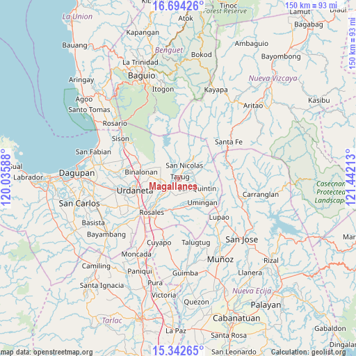
Magallanes GPS coordinates[2]
16° 1' 10.56" North, 120° 44' 20.4" East
| Map corner | latitude | longitude |
|---|---|---|
| Upper-left | 16.69426°, | 120.03588° |
| Center: | 16.0196°, | 120.739° |
| Lower-right: | 15.34265°, | 121.44213° |
| Map W x H: | 150.3×150.3 km | = 93.4×93.4mi |
| max Lat: | 20.78733° ⇑12.1% North |
| Magallanes: | 16.0196° |
| min Lat: | ⇓87.9% South 4.65442° |
| min Long | Magallanes | max Long |
| 117.04868° | 120.739° | 126.58417° |
| W 16.2%⇐ | ⇒83.8% E |
Elevation
Elevation of Magallanes is 62 m = 203 ft, and this is 25.9 m = 85 ft below average elevation for this country.
| Max E: |
2262 m = 7421 ft | 26.6% |
| Avg. | 87.9 m = 288 ft | |
| Magallanes | 62 m = 203 ft | |
Min E: |
-2 m = -7 ft | 73.4% |
See also: Philippines elevation on elevation.city.
Geographical zone
Magallanes is located in North Torrid zone (between Equator and Tropic of Cancer). Distance of this Northern Tropic circle is 824.7 km =512.4 mi to North.| Distance of | km | miles | from Magallanes |
|---|---|---|---|
| North Pole | 8225.8 | 5111.3 | to North |
| Arctic Circle | 5620 | 3492.1 | to North |
| Tropic Cancer | 824.7 | 512.4 | to North |
| Equator | 1781.2 | 1106.8 | to South |


Nearby cities:
15 places around Magallanes: (largest is in red/bold)
• Alac
8 km =5 mi,  116°
116°
• Asingan
7.6 km =4.7 mi,  257°
257°
• Bantog
5.1 km =3.2 mi, 256°
• Baro
7.4 km =4.6 mi,  251°
251°
• Cabalaoangan
6.2 km =3.9 mi,  130°
130°
• Capandanan
8.2 km =5.1 mi,  214°
214°
• Carriedo
2.1 km =1.3 mi,  53°
53°
• Guiset East
7.9 km =4.9 mi,  311°
311°
• Lagasit
6.6 km =4.1 mi, 116°
• Macalong
8.6 km =5.3 mi,  265°
265°
• Natividad
6.9 km =4.3 mi,  66°
66°
• Panganiban
4.1 km =2.5 mi,  109°
109°
• San Nicolas
6.2 km =3.9 mi,  23°
23°
• Santa Maria
6 km =3.7 mi,  223°
223°
• Tayug
1 km =0.6 mi,  28°
28°
Sources, notices
• [Note1] Compared only with cities in Philippines existing in our database
• [Src1] Map data: © OpenStreetMap contributors (CC-BY-SA)
• [Src2] Other city data from geonames.org with taken over terms of usage.
• [Src3] Geographical zone / Annual Mean Temperature by Robert A. Rohde @ Wikipedia
