Lumbayan geodata
Lumbayan (Zamboanga Peninsula) is a populated place; located in Philippines in Asia/Manila (GMT+8) time zone. With population of 2,557 people, there are 3197 cities with bigger population in this country. Compared to other cities in Philippines, 92.3% of cities are located further ↑North; 58.6% of cities are located further →East and 62.8% of cities have higher elevation than Lumbayan. Note1
Administrative division(s):
- Level 1: Zamboanga Peninsula
- Level 2: Province of Zamboanga del Sur
- Level 3: Zamboanga City


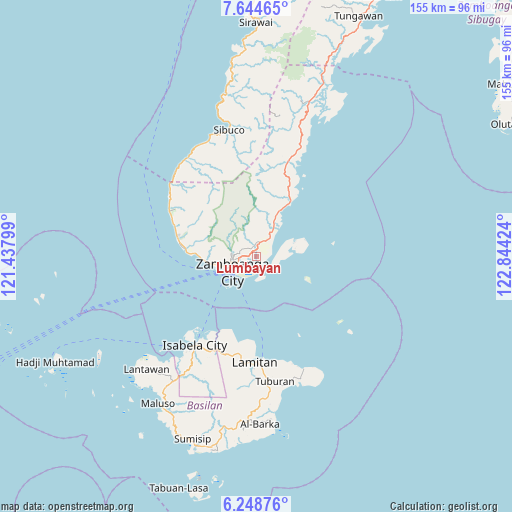
Lumbayan GPS coordinates[2]
6° 56' 49.992" North, 122° 8' 27.996" East
| Map corner | latitude | longitude |
|---|---|---|
| Upper-left | 7.64465°, | 121.43799° |
| Center: | 6.94722°, | 122.14111° |
| Lower-right: | 6.24876°, | 122.84424° |
| Map W x H: | 155.2×155.2 km | = 96.4×96.4mi |
| max Lat: | 20.78733° ⇑92.3% North |
| Lumbayan: | 6.94722° |
| min Lat: | ⇓7.7% South 4.65442° |
| min Long | Lumbayan | max Long |
| 117.04868° | 122.14111° | 126.58417° |
| W 41.4%⇐ | ⇒58.6% E |
Elevation
Elevation of Lumbayan is 15 m = 49 ft, and this is 72.9 m = 239 ft below average elevation for this country.
| Max E: |
2262 m = 7421 ft | 62.8% |
| Avg. | 87.9 m = 288 ft | |
| Lumbayan | 15 m = 49 ft | |
Min E: |
-2 m = -7 ft | 37.2% |
See also: Philippines elevation on elevation.city.
Geographical zone
Lumbayan is located in North Torrid zone (between Equator and Tropic of Cancer). Distance of Equator is 772.5 km =480 mi to South.| Distance of | km | miles | from Lumbayan |
|---|---|---|---|
| North Pole | 9234.6 | 5738.1 | to North |
| Arctic Circle | 6628.7 | 4118.9 | to North |
| Tropic Cancer | 1833.5 | 1139.3 | to North |
| Equator | 772.5 | 480 | to South |


Nearby cities:
15 places around Lumbayan: (largest is in red/bold)
• Bunguiao
18.5 km =11.5 mi,  19°
19°
• Cabaluay
7.4 km =4.6 mi,  35°
35°
• Culianan
3.7 km =2.3 mi,  9°
9°
• Dulian
19.8 km =12.3 mi, 12°
• Lamisahan
13.9 km =8.6 mi, 7°
• Landang Laum
12.2 km =7.6 mi,  78°
78°
• Manicahan
10.4 km =6.5 mi, 39°
• Mercedes
1.5 km =0.9 mi,  32°
32°
• Recodo
19.6 km =12.2 mi,  271°
271°
• Sangali
15.1 km =9.4 mi, 26°
• Talabaan
3.5 km =2.2 mi,  101°
101°
• Taluksangay
4.8 km =3 mi, 80°
• Tigtabon
6.4 km =4 mi,  153°
153°
• Tolosa
9.7 km =6 mi, 13°
• Zamboanga
8.5 km =5.3 mi,  241°
241°
Sources, notices
• [Note1] Compared only with cities in Philippines existing in our database
• [Src1] Map data: © OpenStreetMap contributors (CC-BY-SA)
• [Src2] Other city data from geonames.org with taken over terms of usage.
• [Src3] Geographical zone / Annual Mean Temperature by Robert A. Rohde @ Wikipedia
