Landang Laum geodata
Landang Laum (Zamboanga Peninsula) is a populated place; located in Philippines in Asia/Manila (GMT+8) time zone. With population of 3,542 people, there are 2027 cities with bigger population in this country. Compared to other cities in Philippines, 91.9% of cities are located further ↑North; 57.7% of cities are located further →East and 51.1% of cities have lower elevation than Landang Laum. Note1
Administrative division(s):
- Level 1: Zamboanga Peninsula
- Level 2: Province of Zamboanga del Sur
- Level 3: Zamboanga City


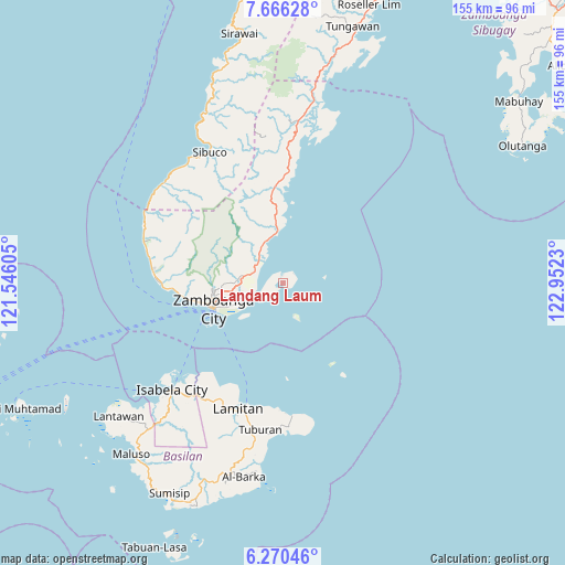
Landang Laum GPS coordinates[2]
6° 58' 8.004" North, 122° 14' 57.012" East
| Map corner | latitude | longitude |
|---|---|---|
| Upper-left | 7.66628°, | 121.54605° |
| Center: | 6.96889°, | 122.24917° |
| Lower-right: | 6.27046°, | 122.9523° |
| Map W x H: | 155.2×155.2 km | = 96.4×96.4mi |
| max Lat: | 20.78733° ⇑91.9% North |
| Landang Laum: | 6.96889° |
| min Lat: | ⇓8.1% South 4.65442° |
| min Long | Landang Laum | max Long |
| 117.04868° | 122.24917° | 126.58417° |
| W 42.3%⇐ | ⇒57.7% E |
Elevation
Elevation of Landang Laum is 24 m = 79 ft, and this is 63.9 m = 210 ft below average elevation for this country.
| Max E: |
2262 m = 7421 ft | 48.9% |
| Avg. | 87.9 m = 288 ft | |
| Landang Laum | 24 m = 79 ft | |
Min E: |
-2 m = -7 ft | 51.1% |
See also: Philippines elevation on elevation.city.
Geographical zone
Landang Laum is located in North Torrid zone (between Equator and Tropic of Cancer). Distance of Equator is 774.9 km =481.5 mi to South.| Distance of | km | miles | from Landang Laum |
|---|---|---|---|
| North Pole | 9232.2 | 5736.6 | to North |
| Arctic Circle | 6626.3 | 4117.4 | to North |
| Tropic Cancer | 1831.1 | 1137.8 | to North |
| Equator | 774.9 | 481.5 | to South |


Nearby cities:
15 places around Landang Laum: (largest is in red/bold)
• Bolong
14.4 km =8.9 mi,  355°
355°
• Bunguiao
16.2 km =10.1 mi,  338°
338°
• Cabaluay
8.4 km =5.2 mi,  295°
295°
• Culianan
11.4 km =7.1 mi,  276°
276°
• Dulian
18.6 km =11.6 mi, 335°
• Lamisahan
15.1 km =9.4 mi,  318°
318°
• Lumbayan
12.2 km =7.6 mi,  258°
258°
• Manicahan
7.7 km =4.8 mi, 316°
• Mercedes
11.2 km =7 mi, 264°
• Sangali
12.4 km =7.7 mi,  334°
334°
• Talabaan
9 km =5.6 mi,  250°
250°
• Taluksangay
7.4 km =4.6 mi, 257°
• Tigtabon
12.2 km =7.6 mi,  228°
228°
• Tolosa
12 km =7.5 mi,  306°
306°
• Zamboanga
20.4 km =12.7 mi, 251°
Sources, notices
• [Note1] Compared only with cities in Philippines existing in our database
• [Src1] Map data: © OpenStreetMap contributors (CC-BY-SA)
• [Src2] Other city data from geonames.org with taken over terms of usage.
• [Src3] Geographical zone / Annual Mean Temperature by Robert A. Rohde @ Wikipedia
