Loreto geodata
Loreto (Caraga) is a seat of a third-order administrative division; located in Philippines in Asia/Manila (GMT+8) time zone. With population of 5,397 people, there are 1179 cities with bigger population in this country. Compared to other cities in Philippines, 64.5% of cities are located further ↑North; 94.3% of cities are located further ←West and 71.5% of cities have lower elevation than Loreto. Note1


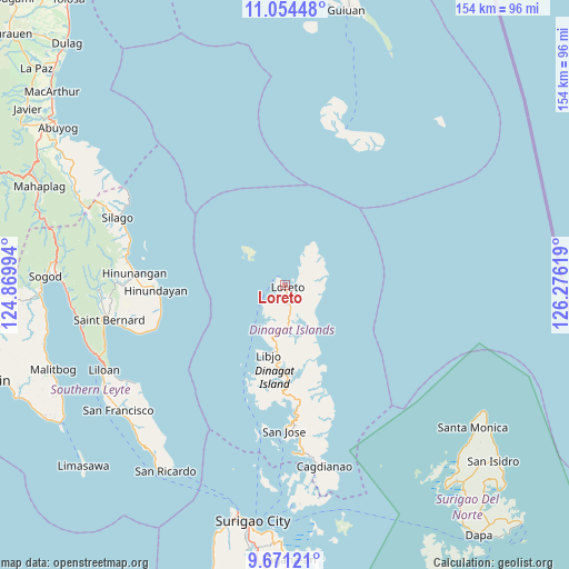
Loreto GPS coordinates[2]
10° 21' 48.996" North, 125° 34' 23.016" East
| Map corner | latitude | longitude |
|---|---|---|
| Upper-left | 11.05448°, | 124.86994° |
| Center: | 10.36361°, | 125.57306° |
| Lower-right: | 9.67121°, | 126.27619° |
| Map W x H: | 153.8×153.8 km | = 95.6×95.6mi |
| max Lat: | 20.78733° ⇑64.5% North |
| Loreto: | 10.36361° |
| min Lat: | ⇓35.5% South 4.65442° |
| min Long | Loreto | max Long |
| 117.04868° | 125.57306° | 126.58417° |
| W 94.3%⇐ | ⇒5.7% E |
Elevation
Elevation of Loreto is 56 m = 184 ft, and this is 31.9 m = 105 ft below average elevation for this country.
| Max E: |
2262 m = 7421 ft | 28.5% |
| Avg. | 87.9 m = 288 ft | |
| Loreto | 56 m = 184 ft | |
Min E: |
-2 m = -7 ft | 71.5% |
See also: Philippines elevation on elevation.city.
Geographical zone
Loreto is located in North Torrid zone (between Equator and Tropic of Cancer). Distance of Equator is 1152.3 km =716 mi to South.| Distance of | km | miles | from Loreto |
|---|---|---|---|
| North Pole | 8854.7 | 5502.1 | to North |
| Arctic Circle | 6248.8 | 3882.8 | to North |
| Tropic Cancer | 1453.6 | 903.2 | to North |
| Equator | 1152.3 | 716 | to South |


Nearby cities:
15 places around Loreto: (largest is in red/bold)
• Anahawan
35.3 km =21.9 mi,  254°
254°
• Basilisa
41.2 km =25.6 mi,  191°
191°
• Cagdianao
50.3 km =31.3 mi,  167°
167°
• Dinagat
45.4 km =28.2 mi,  177°
177°
• Hingatungan
49 km =30.4 mi,  300°
300°
• Hinunangan
41.2 km =25.6 mi,  274°
274°
• Hinundayan
35.3 km =21.9 mi, 267°
• Libjo
18.9 km =11.7 mi, 192°
• Liloan
54.8 km =34.1 mi, 245°
• Saint Bernard
43.6 km =27.1 mi,  258°
258°
• San Francisco
56.4 km =35 mi,  233°
233°
• San Jose
20.4 km =12.7 mi, 181°
• San Juan
44.8 km =27.8 mi, 256°
• Silago
48.6 km =30.2 mi,  292°
292°
• Tubajon
3.8 km =2.4 mi,  198°
198°
Sources, notices
• [Note1] Compared only with cities in Philippines existing in our database
• [Src1] Map data: © OpenStreetMap contributors (CC-BY-SA)
• [Src2] Other city data from geonames.org with taken over terms of usage.
• [Src3] Geographical zone / Annual Mean Temperature by Robert A. Rohde @ Wikipedia
