Lingayen geodata
Lingayen (Ilocos) is a seat of a third-order administrative division; located in Philippines in Asia/Manila (GMT+8) time zone. With population of 56,580 people, there are 164 cities with bigger population in this country. Compared to other cities in Philippines, 87.9% of cities are located further ↓South; 95.9% of cities are located further →East and 80.7% of cities have higher elevation than Lingayen. Note1


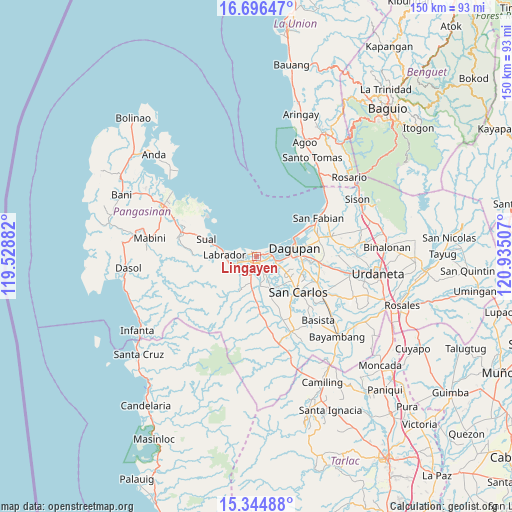
Lingayen GPS coordinates[2]
16° 1' 18.552" North, 120° 13' 54.984" East
| Map corner | latitude | longitude |
|---|---|---|
| Upper-left | 16.69647°, | 119.52882° |
| Center: | 16.02182°, | 120.23194° |
| Lower-right: | 15.34488°, | 120.93507° |
| Map W x H: | 150.3×150.3 km | = 93.4×93.4mi |
| max Lat: | 20.78733° ⇑12.1% North |
| Lingayen: | 16.02182° |
| min Lat: | ⇓87.9% South 4.65442° |
| min Long | Lingayen | max Long |
| 117.04868° | 120.23194° | 126.58417° |
| W 4.1%⇐ | ⇒95.9% E |
Elevation
Elevation of Lingayen is 9 m = 30 ft, and this is 78.9 m = 259 ft below average elevation for this country.
| Max E: |
2262 m = 7421 ft | 80.7% |
| Avg. | 87.9 m = 288 ft | |
| Lingayen | 9 m = 30 ft | |
Min E: |
-2 m = -7 ft | 19.3% |
See also: Lingayen elevation on elevation.city.
Geographical zone
Lingayen is located in North Torrid zone (between Equator and Tropic of Cancer). Distance of this Northern Tropic circle is 824.5 km =512.3 mi to North.| Distance of | km | miles | from Lingayen |
|---|---|---|---|
| North Pole | 8225.6 | 5111.1 | to North |
| Arctic Circle | 5619.7 | 3491.9 | to North |
| Tropic Cancer | 824.5 | 512.3 | to North |
| Equator | 1781.5 | 1107 | to South |


Nearby cities:
15 places around Lingayen: (largest is in red/bold)
• Balogo
6.5 km =4 mi,  122°
122°
• Basing
5.6 km =3.5 mi,  136°
136°
• Binmaley
4.1 km =2.5 mi,  73°
73°
• Bolo
7.8 km =4.8 mi,  247°
247°
• Boñgalon
8.2 km =5.1 mi, 252°
• Bugallon
7.9 km =4.9 mi,  192°
192°
• Camaley
7.9 km =4.9 mi,  110°
110°
• Canaoalan
6.9 km =4.3 mi,  83°
83°
• Domalanoan
3 km =1.9 mi,  226°
226°
• Dulig
7.1 km =4.4 mi, 252°
• Gayaman
8.1 km =5 mi,  96°
96°
• Magtaking
6.6 km =4.1 mi, 232°
• Naguelguel
3.8 km =2.4 mi, 117°
• Naguilayan
6.7 km =4.2 mi, 108°
• Polong
6 km =3.7 mi,  213°
213°
Sources, notices
• [Note1] Compared only with cities in Philippines existing in our database
• [Src1] Map data: © OpenStreetMap contributors (CC-BY-SA)
• [Src2] Other city data from geonames.org with taken over terms of usage.
• [Src3] Geographical zone / Annual Mean Temperature by Robert A. Rohde @ Wikipedia
