Lañgub geodata
Lañgub (Western Visayas) is a populated place; located in Philippines in Asia/Manila (GMT+8) time zone. With population of 3,039 people, there are 2483 cities with bigger population in this country. Compared to other cities in Philippines, 59.5% of cities are located further ↑North; 62.9% of cities are located further ←West and 56.1% of cities have higher elevation than Lañgub. Note1
Administrative division(s):
- Level 1: Western Visayas
- Level 2: Province of Negros Occidental
- Level 3: City of Escalante


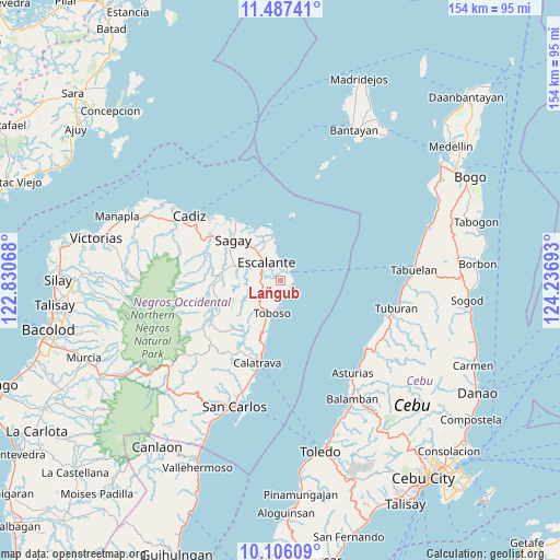
Lañgub GPS coordinates[2]
10° 47' 51.144" North, 123° 32' 1.68" East
| Map corner | latitude | longitude |
|---|---|---|
| Upper-left | 11.48741°, | 122.83068° |
| Center: | 10.79754°, | 123.5338° |
| Lower-right: | 10.10609°, | 124.23693° |
| Map W x H: | 153.6×153.6 km | = 95.4×95.4mi |
| max Lat: | 20.78733° ⇑59.5% North |
| Lañgub: | 10.79754° |
| min Lat: | ⇓40.5% South 4.65442° |
| min Long | Lañgub | max Long |
| 117.04868° | 123.5338° | 126.58417° |
| W 62.9%⇐ | ⇒37.1% E |
Elevation
Elevation of Lañgub is 19 m = 62 ft, and this is 68.9 m = 226 ft below average elevation for this country.
| Max E: |
2262 m = 7421 ft | 56.1% |
| Avg. | 87.9 m = 288 ft | |
| Lañgub | 19 m = 62 ft | |
Min E: |
-2 m = -7 ft | 43.9% |
See also: Philippines elevation on elevation.city.
Geographical zone
Lañgub is located in North Torrid zone (between Equator and Tropic of Cancer). Distance of Equator is 1200.6 km =746 mi to South.| Distance of | km | miles | from Lañgub |
|---|---|---|---|
| North Pole | 8806.5 | 5472.1 | to North |
| Arctic Circle | 6200.6 | 3852.9 | to North |
| Tropic Cancer | 1405.3 | 873.2 | to North |
| Equator | 1200.6 | 746 | to South |


Nearby cities:
15 places around Lañgub: (largest is in red/bold)
• Bolanon
14.8 km =9.2 mi,  333°
333°
• Buenavista
2.3 km =1.4 mi,  86°
86°
• Cervantes
8.5 km =5.3 mi,  350°
350°
• Dian-ay
4.4 km =2.7 mi,  23°
23°
• Escalante
6.1 km =3.8 mi,  321°
321°
• Japitan
3.8 km =2.4 mi,  162°
162°
• Libertad
5.4 km =3.4 mi,  42°
42°
• Lopez Jaena
14.2 km =8.8 mi,  293°
293°
• Mabini
5.4 km =3.4 mi,  268°
268°
• Ogtongon
3.1 km =1.9 mi,  209°
209°
• Plaridel
12.1 km =7.5 mi,  336°
336°
• Salamanca
5.7 km =3.5 mi,  184°
184°
• Tamlang
9.2 km =5.7 mi, 289°
• Toboso
9.4 km =5.8 mi,  191°
191°
• Vito
11.9 km =7.4 mi, 350°
Sources, notices
• [Note1] Compared only with cities in Philippines existing in our database
• [Src1] Map data: © OpenStreetMap contributors (CC-BY-SA)
• [Src2] Other city data from geonames.org with taken over terms of usage.
• [Src3] Geographical zone / Annual Mean Temperature by Robert A. Rohde @ Wikipedia
