Escalante geodata
Escalante (Western Visayas) is a seat of a third-order administrative division; located in Philippines in Asia/Manila (GMT+8) time zone. With population of 39,177 people, there are 224 cities with bigger population in this country. Compared to other cities in Philippines, 58.8% of cities are located further ↑North; 62.1% of cities are located further ←West and 53.5% of cities have lower elevation than Escalante. Note1
Administrative division(s):
- Level 1: Western Visayas
- Level 2: Province of Negros Occidental
- Level 3: City of Escalante


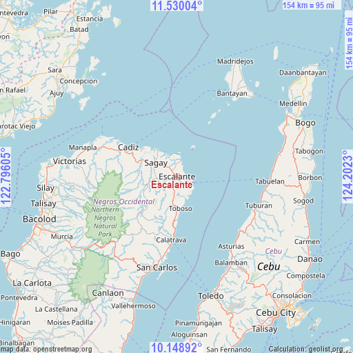
Escalante GPS coordinates[2]
10° 50' 25.008" North, 123° 29' 57.012" East
| Map corner | latitude | longitude |
|---|---|---|
| Upper-left | 11.53004°, | 122.79605° |
| Center: | 10.84028°, | 123.49917° |
| Lower-right: | 10.14892°, | 124.2023° |
| Map W x H: | 153.6×153.6 km | = 95.4×95.4mi |
| max Lat: | 20.78733° ⇑58.8% North |
| Escalante: | 10.84028° |
| min Lat: | ⇓41.2% South 4.65442° |
| min Long | Escalante | max Long |
| 117.04868° | 123.49917° | 126.58417° |
| W 62.1%⇐ | ⇒37.9% E |
Elevation
Elevation of Escalante is 26 m = 85 ft, and this is 61.9 m = 203 ft below average elevation for this country.
| Max E: |
2262 m = 7421 ft | 46.5% |
| Avg. | 87.9 m = 288 ft | |
| Escalante | 26 m = 85 ft | |
Min E: |
-2 m = -7 ft | 53.5% |
See also: Philippines elevation on elevation.city.
Geographical zone
Escalante is located in North Torrid zone (between Equator and Tropic of Cancer). Distance of Equator is 1205.3 km =748.9 mi to South.| Distance of | km | miles | from Escalante |
|---|---|---|---|
| North Pole | 8801.7 | 5469.1 | to North |
| Arctic Circle | 6195.8 | 3849.9 | to North |
| Tropic Cancer | 1400.6 | 870.3 | to North |
| Equator | 1205.3 | 748.9 | to South |


Nearby cities:
15 places around Escalante: (largest is in red/bold)
• Bolanon
9 km =5.6 mi,  341°
341°
• Buenavista
7.6 km =4.7 mi,  127°
127°
• Cervantes
4.3 km =2.7 mi,  33°
33°
• Dian-ay
5.6 km =3.5 mi,  97°
97°
• Japitan
9.7 km =6 mi,  149°
149°
• Lañgub
6.1 km =3.8 mi,  141°
141°
• Libertad
7.4 km =4.6 mi, 95°
• Lopez Jaena
9.3 km =5.8 mi,  275°
275°
• Mabini
5.2 km =3.2 mi,  197°
197°
• Ogtongon
7.8 km =4.8 mi,  163°
163°
• Plaridel
6.4 km =4 mi,  350°
350°
• Rizal
10 km =6.2 mi,  296°
296°
• Salamanca
11 km =6.8 mi, 162°
• Tamlang
5.2 km =3.2 mi,  251°
251°
• Vito
7.2 km =4.5 mi,  14°
14°
Sources, notices
• [Note1] Compared only with cities in Philippines existing in our database
• [Src1] Map data: © OpenStreetMap contributors (CC-BY-SA)
• [Src2] Other city data from geonames.org with taken over terms of usage.
• [Src3] Geographical zone / Annual Mean Temperature by Robert A. Rohde @ Wikipedia
