Kitobo geodata
Kitobo (Northern Mindanao) is a populated place; located in Philippines in Asia/Manila (GMT+8) time zone. With population of 2,205 people, there are 3881 cities with bigger population in this country. Compared to other cities in Philippines, 86.3% of cities are located further ↑North; 89.2% of cities are located further ←West and 90% of cities have lower elevation than Kitobo. Note1
Administrative division(s):
- Level 1: Northern Mindanao
- Level 2: Province of Bukidnon
- Level 3: Kitaotao


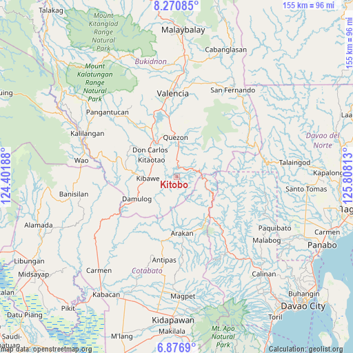
Kitobo GPS coordinates[2]
7° 34' 27.984" North, 125° 6' 18" East
| Map corner | latitude | longitude |
|---|---|---|
| Upper-left | 8.27085°, | 124.40188° |
| Center: | 7.57444°, | 125.105° |
| Lower-right: | 6.8769°, | 125.80813° |
| Map W x H: | 155×155 km | = 96.3×96.3mi |
| max Lat: | 20.78733° ⇑86.3% North |
| Kitobo: | 7.57444° |
| min Lat: | ⇓13.7% South 4.65442° |
| min Long | Kitobo | max Long |
| 117.04868° | 125.105° | 126.58417° |
| W 89.2%⇐ | ⇒10.8% E |
Elevation
Elevation of Kitobo is 227 m = 745 ft, and this is 139.1 m = 456 ft above average elevation for this country.
| Max E: |
2262 m = 7421 ft | 10% |
| Kitobo | 227 m 745 ft | |
| Avg. | 87.9 m = 288 ft | |
Min E: |
-2 m = -7 ft | 90% |
See also: Philippines elevation on elevation.city.
Geographical zone
Kitobo is located in North Torrid zone (between Equator and Tropic of Cancer). Distance of Equator is 842.2 km =523.3 mi to South.| Distance of | km | miles | from Kitobo |
|---|---|---|---|
| North Pole | 9164.9 | 5694.8 | to North |
| Arctic Circle | 6559 | 4075.6 | to North |
| Tropic Cancer | 1763.7 | 1095.9 | to North |
| Equator | 842.2 | 523.3 | to South |


Nearby cities:
15 places around Kitobo: (largest is in red/bold)
• Dalorong
3.3 km =2.1 mi,  67°
67°
• Damulog
20.5 km =12.7 mi,  240°
240°
• Dancagan
11.8 km =7.3 mi,  289°
289°
• Don Carlos
16.1 km =10 mi,  316°
316°
• Kadingilan
21.8 km =13.5 mi,  277°
277°
• Kibawe
12.9 km =8 mi,  267°
267°
• Kibureau
19.6 km =12.2 mi,  45°
45°
• Kitaotao
12.8 km =8 mi,  304°
304°
• Miaray
6.7 km =4.2 mi, 270°
• Natalungan
10.2 km =6.3 mi, 242°
• Quezon
17.3 km =10.7 mi,  357°
357°
• Salawagan
14.6 km =9.1 mi,  4°
4°
• Sampagar
17.8 km =11.1 mi,  247°
247°
• San Jose
18.4 km =11.4 mi,  348°
348°
• San Vicente
11.5 km =7.1 mi, 317°
Sources, notices
• [Note1] Compared only with cities in Philippines existing in our database
• [Src1] Map data: © OpenStreetMap contributors (CC-BY-SA)
• [Src2] Other city data from geonames.org with taken over terms of usage.
• [Src3] Geographical zone / Annual Mean Temperature by Robert A. Rohde @ Wikipedia
