Don Carlos geodata
Don Carlos (Northern Mindanao) is a seat of a third-order administrative division; located in Philippines in Asia/Manila (GMT+8) time zone. With population of 20,468 people, there are 364 cities with bigger population in this country. Compared to other cities in Philippines, 85.3% of cities are located further ↑North; 87.7% of cities are located further ←West and 92.5% of cities have lower elevation than Don Carlos. Note1
Administrative division(s):
- Level 1: Northern Mindanao
- Level 2: Province of Bukidnon
- Level 3: Don Carlos


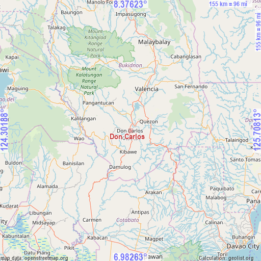
Don Carlos GPS coordinates[2]
7° 40' 48" North, 125° 0' 18" East
| Map corner | latitude | longitude |
|---|---|---|
| Upper-left | 8.37623°, | 124.30188° |
| Center: | 7.68°, | 125.005° |
| Lower-right: | 6.98263°, | 125.70813° |
| Map W x H: | 155×155 km | = 96.3×96.3mi |
| max Lat: | 20.78733° ⇑85.3% North |
| Don Carlos: | 7.68° |
| min Lat: | ⇓14.7% South 4.65442° |
| min Long | Don Carlos | max Long |
| 117.04868° | 125.005° | 126.58417° |
| W 87.7%⇐ | ⇒12.3% E |
Elevation
Elevation of Don Carlos is 307 m = 1007 ft, and this is 219.1 m = 719 ft above average elevation for this country.
| Max E: |
2262 m = 7421 ft | 7.5% |
| Don Carlos | 307 m 1007 ft | |
| Avg. | 87.9 m = 288 ft | |
Min E: |
-2 m = -7 ft | 92.5% |
See also: Philippines elevation on elevation.city.
Geographical zone
Don Carlos is located in North Torrid zone (between Equator and Tropic of Cancer). Distance of Equator is 853.9 km =530.6 mi to South.| Distance of | km | miles | from Don Carlos |
|---|---|---|---|
| North Pole | 9153.1 | 5687.5 | to North |
| Arctic Circle | 6547.2 | 4068.2 | to North |
| Tropic Cancer | 1752 | 1088.6 | to North |
| Equator | 853.9 | 530.6 | to South |


Nearby cities:
15 places around Don Carlos: (largest is in red/bold)
• Dalorong
17.5 km =10.9 mi,  126°
126°
• Dancagan
7.9 km =4.9 mi,  180°
180°
• Dologon
18.4 km =11.4 mi,  13°
13°
• Kadingilan
13.8 km =8.6 mi,  230°
230°
• Kibawe
12.5 km =7.8 mi,  188°
188°
• Kitaotao
4.5 km =2.8 mi,  174°
174°
• Kitobo
16.1 km =10 mi,  136°
136°
• Maramag
9.3 km =5.8 mi,  0°
0°
• Miaray
12.5 km =7.8 mi,  159°
159°
• Natalungan
16.6 km =10.3 mi, 172°
• Quezon
11.8 km =7.3 mi,  61°
61°
• Salawagan
12.4 km =7.7 mi,  76°
76°
• Sampagar
19.3 km =12 mi,  196°
196°
• San Jose
9.6 km =6 mi,  48°
48°
• San Vicente
4.6 km =2.9 mi, 134°
Sources, notices
• [Note1] Compared only with cities in Philippines existing in our database
• [Src1] Map data: © OpenStreetMap contributors (CC-BY-SA)
• [Src2] Other city data from geonames.org with taken over terms of usage.
• [Src3] Geographical zone / Annual Mean Temperature by Robert A. Rohde @ Wikipedia
