Sampagar geodata
Sampagar (Northern Mindanao) is a populated place; located in Philippines in Asia/Manila (GMT+8) time zone. With population of 2,207 people, there are 3875 cities with bigger population in this country. Compared to other cities in Philippines, 86.9% of cities are located further ↑North; 86.9% of cities are located further ←West and 94.7% of cities have lower elevation than Sampagar. Note1
Administrative division(s):
- Level 1: Northern Mindanao
- Level 2: Province of Bukidnon
- Level 3: Damulog


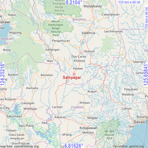
Sampagar GPS coordinates[2]
7° 30' 50.004" North, 124° 57' 19.008" East
| Map corner | latitude | longitude |
|---|---|---|
| Upper-left | 8.2104°, | 124.25216° |
| Center: | 7.51389°, | 124.95528° |
| Lower-right: | 6.81626°, | 125.65841° |
| Map W x H: | 155×155 km | = 96.3×96.3mi |
| max Lat: | 20.78733° ⇑86.9% North |
| Sampagar: | 7.51389° |
| min Lat: | ⇓13.1% South 4.65442° |
| min Long | Sampagar | max Long |
| 117.04868° | 124.95528° | 126.58417° |
| W 86.9%⇐ | ⇒13.1% E |
Elevation
Elevation of Sampagar is 398 m = 1306 ft, and this is 310.1 m = 1017 ft above average elevation for this country.
| Max E: |
2262 m = 7421 ft | 5.3% |
| Sampagar | 398 m 1306 ft | |
| Avg. | 87.9 m = 288 ft | |
Min E: |
-2 m = -7 ft | 94.7% |
See also: Philippines elevation on elevation.city.
Geographical zone
Sampagar is located in North Torrid zone (between Equator and Tropic of Cancer). Distance of Equator is 835.5 km =519.2 mi to South.| Distance of | km | miles | from Sampagar |
|---|---|---|---|
| North Pole | 9171.6 | 5699 | to North |
| Arctic Circle | 6565.7 | 4079.7 | to North |
| Tropic Cancer | 1770.5 | 1100.1 | to North |
| Equator | 835.5 | 519.2 | to South |


Nearby cities:
15 places around Sampagar: (largest is in red/bold)
• Banisilan
25.6 km =15.9 mi,  264°
264°
• Dalorong
21.1 km =13.1 mi,  67°
67°
• Damulog
3.6 km =2.2 mi,  201°
201°
• Dancagan
11.9 km =7.4 mi,  26°
26°
• Don Carlos
19.3 km =12 mi,  16°
16°
• Kadingilan
11 km =6.8 mi,  332°
332°
• Kibawe
7.1 km =4.4 mi, 30°
• Kitaotao
15.2 km =9.4 mi, 22°
• Kitobo
17.8 km =11.1 mi, 67°
• Liliongan
24.6 km =15.3 mi,  226°
226°
• Miaray
11.9 km =7.4 mi,  55°
55°
• Natalungan
7.8 km =4.8 mi,  75°
75°
• Osias
18 km =11.2 mi,  302°
302°
• Salawagan
27.6 km =17.1 mi,  39°
39°
• San Vicente
17.6 km =10.9 mi, 29°
Sources, notices
• [Note1] Compared only with cities in Philippines existing in our database
• [Src1] Map data: © OpenStreetMap contributors (CC-BY-SA)
• [Src2] Other city data from geonames.org with taken over terms of usage.
• [Src3] Geographical zone / Annual Mean Temperature by Robert A. Rohde @ Wikipedia
