Kabulohan geodata
Kabulohan (Northern Mindanao) is a populated place; located in Philippines in Asia/Manila (GMT+8) time zone. With population of 2,637 people, there are 3057 cities with bigger population in this country. Compared to other cities in Philippines, 82.2% of cities are located further ↑North; 91% of cities are located further ←West and 94.8% of cities have lower elevation than Kabulohan. Note1
Administrative division(s):
- Level 1: Northern Mindanao
- Level 2: Province of Bukidnon
- Level 3: Cabanglasan


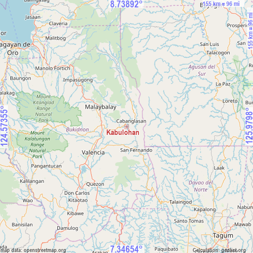
Kabulohan GPS coordinates[2]
8° 2' 35.988" North, 125° 16' 36.012" East
| Map corner | latitude | longitude |
|---|---|---|
| Upper-left | 8.73892°, | 124.57355° |
| Center: | 8.04333°, | 125.27667° |
| Lower-right: | 7.34654°, | 125.9798° |
| Map W x H: | 154.8×154.8 km | = 96.2×96.2mi |
| max Lat: | 20.78733° ⇑82.2% North |
| Kabulohan: | 8.04333° |
| min Lat: | ⇓17.8% South 4.65442° |
| min Long | Kabulohan | max Long |
| 117.04868° | 125.27667° | 126.58417° |
| W 91%⇐ | ⇒9% E |
Elevation
Elevation of Kabulohan is 400 m = 1312 ft, and this is 312.1 m = 1024 ft above average elevation for this country.
| Max E: |
2262 m = 7421 ft | 5.2% |
| Kabulohan | 400 m 1312 ft | |
| Avg. | 87.9 m = 288 ft | |
Min E: |
-2 m = -7 ft | 94.8% |
See also: Philippines elevation on elevation.city.
Geographical zone
Kabulohan is located in North Torrid zone (between Equator and Tropic of Cancer). Distance of Equator is 894.3 km =555.7 mi to South.| Distance of | km | miles | from Kabulohan |
|---|---|---|---|
| North Pole | 9112.7 | 5662.4 | to North |
| Arctic Circle | 6506.8 | 4043.1 | to North |
| Tropic Cancer | 1711.6 | 1063.5 | to North |
| Equator | 894.3 | 555.7 | to South |


Nearby cities:
15 places around Kabulohan: (largest is in red/bold)
• Aglayan
15.7 km =9.8 mi,  274°
274°
• Bugcaon
18 km =11.2 mi, 270°
• Cabangahan
15.5 km =9.6 mi,  261°
261°
• Cabanglasan
10.3 km =6.4 mi,  32°
32°
• Casisang
19.7 km =12.2 mi,  302°
302°
• Halapitan
15.2 km =9.4 mi,  157°
157°
• Imbatug
1.5 km =0.9 mi, 32°
• Laguitas
16.9 km =10.5 mi,  287°
287°
• Linabo
13.4 km =8.3 mi,  275°
275°
• Little Baguio
16.6 km =10.3 mi,  180°
180°
• Lumbayao
12.5 km =7.8 mi, 256°
• Maglamin
1.9 km =1.2 mi, 300°
• Mailag
17.3 km =10.7 mi,  242°
242°
• Managok
9.8 km =6.1 mi, 260°
• Silae
12.9 km =8 mi,  2°
2°
Sources, notices
• [Note1] Compared only with cities in Philippines existing in our database
• [Src1] Map data: © OpenStreetMap contributors (CC-BY-SA)
• [Src2] Other city data from geonames.org with taken over terms of usage.
• [Src3] Geographical zone / Annual Mean Temperature by Robert A. Rohde @ Wikipedia
