Jaena geodata
Jaena (Western Visayas) is a populated place; located in Philippines in Asia/Manila (GMT+8) time zone. With population of 4,272 people, there are 1602 cities with bigger population in this country. Compared to other cities in Philippines, 52.4% of cities are located further ↑North; 56.2% of cities are located further →East and 87.7% of cities have lower elevation than Jaena. Note1


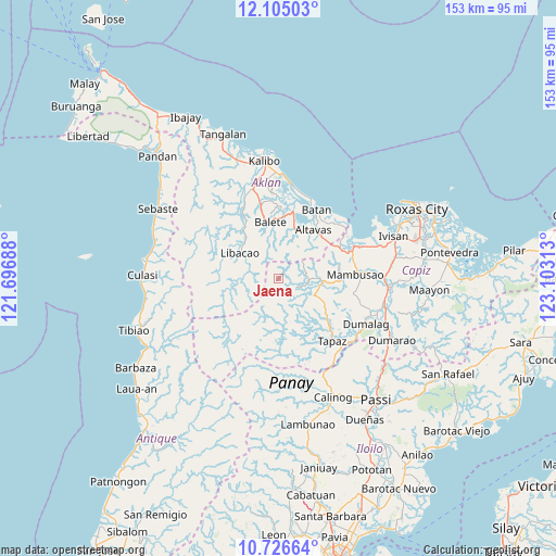
Jaena GPS coordinates[2]
11° 25' 0.012" North, 122° 24' 0" East
| Map corner | latitude | longitude |
|---|---|---|
| Upper-left | 12.10503°, | 121.69688° |
| Center: | 11.41667°, | 122.4° |
| Lower-right: | 10.72664°, | 123.10313° |
| Map W x H: | 153.3×153.3 km | = 95.3×95.3mi |
| max Lat: | 20.78733° ⇑52.4% North |
| Jaena: | 11.41667° |
| min Lat: | ⇓47.6% South 4.65442° |
| min Long | Jaena | max Long |
| 117.04868° | 122.4° | 126.58417° |
| W 43.8%⇐ | ⇒56.2% E |
Elevation
Elevation of Jaena is 176 m = 577 ft, and this is 88.1 m = 289 ft above average elevation for this country.
| Max E: |
2262 m = 7421 ft | 12.3% |
| Jaena | 176 m 577 ft | |
| Avg. | 87.9 m = 288 ft | |
Min E: |
-2 m = -7 ft | 87.7% |
See also: Philippines elevation on elevation.city.
Geographical zone
Jaena is located in North Torrid zone (between Equator and Tropic of Cancer). Distance of Equator is 1269.4 km =788.8 mi to South.| Distance of | km | miles | from Jaena |
|---|---|---|---|
| North Pole | 8737.6 | 5429.3 | to North |
| Arctic Circle | 6131.8 | 3810.1 | to North |
| Tropic Cancer | 1336.5 | 830.5 | to North |
| Equator | 1269.4 | 788.8 | to South |


Nearby cities:
15 places around Jaena: (largest is in red/bold)
• Ag-ambulong
13.1 km =8.1 mi,  114°
114°
• Altavas
16.5 km =10.3 mi,  35°
35°
• Aranas Sur
16.4 km =10.2 mi,  356°
356°
• Arcangel
14.9 km =9.3 mi,  336°
336°
• Balete
15.6 km =9.7 mi,  352°
352°
• Cortez
12.6 km =7.8 mi, 358°
• Jamindan
10.9 km =6.8 mi,  99°
99°
• Libacao
12.6 km =7.8 mi,  304°
304°
• Lucero
8.2 km =5.1 mi,  59°
59°
• Lupo
13.3 km =8.3 mi, 40°
• Madalag
15.9 km =9.9 mi,  320°
320°
• Manika
13.5 km =8.4 mi,  256°
256°
• Manup
16.6 km =10.3 mi, 39°
• Morales
14.6 km =9.1 mi, 349°
• Odiong
15.1 km =9.4 mi,  28°
28°
Sources, notices
• [Note1] Compared only with cities in Philippines existing in our database
• [Src1] Map data: © OpenStreetMap contributors (CC-BY-SA)
• [Src2] Other city data from geonames.org with taken over terms of usage.
• [Src3] Geographical zone / Annual Mean Temperature by Robert A. Rohde @ Wikipedia
