Eguia geodata
Eguia (Ilocos) is a populated place; located in Philippines in Asia/Manila (GMT+8) time zone. With population of 3,033 people, there are 2491 cities with bigger population in this country. Compared to other cities in Philippines, 86.2% of cities are located further ↓South; 98% of cities are located further →East and 76.6% of cities have higher elevation than Eguia. Note1


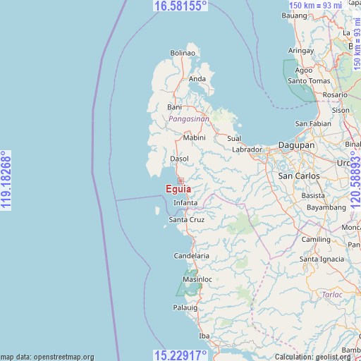
Eguia GPS coordinates[2]
15° 54' 23.4" North, 119° 53' 8.88" East
| Map corner | latitude | longitude |
|---|---|---|
| Upper-left | 16.58155°, | 119.18268° |
| Center: | 15.9065°, | 119.8858° |
| Lower-right: | 15.22917°, | 120.58893° |
| Map W x H: | 150.4×150.4 km | = 93.5×93.5mi |
| max Lat: | 20.78733° ⇑13.8% North |
| Eguia: | 15.9065° |
| min Lat: | ⇓86.2% South 4.65442° |
| min Long | Eguia | max Long |
| 117.04868° | 119.8858° | 126.58417° |
| W 2%⇐ | ⇒98% E |
Elevation
Elevation of Eguia is 10 m = 33 ft, and this is 77.9 m = 256 ft below average elevation for this country.
| Max E: |
2262 m = 7421 ft | 76.6% |
| Avg. | 87.9 m = 288 ft | |
| Eguia | 10 m = 33 ft | |
Min E: |
-2 m = -7 ft | 23.4% |
See also: Philippines elevation on elevation.city.
Geographical zone
Eguia is located in North Torrid zone (between Equator and Tropic of Cancer). Distance of this Northern Tropic circle is 837.3 km =520.3 mi to North.| Distance of | km | miles | from Eguia |
|---|---|---|---|
| North Pole | 8238.4 | 5119.1 | to North |
| Arctic Circle | 5632.5 | 3499.9 | to North |
| Tropic Cancer | 837.3 | 520.3 | to North |
| Equator | 1768.6 | 1099 | to South |


Nearby cities:
15 places around Eguia: (largest is in red/bold)
• Agno
25.1 km =15.6 mi,  338°
338°
• Bangan-Oda
23.2 km =14.4 mi,  345°
345°
• Biay
18.6 km =11.6 mi,  173°
173°
• Bolitoc
18.6 km =11.6 mi,  182°
182°
• Burgos
17 km =10.6 mi, 352°
• Caabiangan
20.5 km =12.7 mi,  11°
11°
• Cato
8.4 km =5.2 mi,  158°
158°
• Dasol
9.3 km =5.8 mi,  358°
358°
• Guisguis
15.9 km =9.9 mi,  142°
142°
• Ilioilio
14.2 km =8.8 mi,  295°
295°
• Infanta
9.2 km =5.7 mi, 165°
• Lucapon
23.5 km =14.6 mi, 167°
• Mabini
19 km =11.8 mi,  17°
17°
• Santa Cruz
15.9 km =9.9 mi, 170°
• Tagudin
20.7 km =12.9 mi, 20°
Sources, notices
• [Note1] Compared only with cities in Philippines existing in our database
• [Src1] Map data: © OpenStreetMap contributors (CC-BY-SA)
• [Src2] Other city data from geonames.org with taken over terms of usage.
• [Src3] Geographical zone / Annual Mean Temperature by Robert A. Rohde @ Wikipedia
