Tagudin geodata
Tagudin (Ilocos) is a populated place; located in Philippines in Asia/Manila (GMT+8) time zone. With population of 3,052 people, there are 2471 cities with bigger population in this country. Compared to other cities in Philippines, 88.4% of cities are located further ↓South; 97.4% of cities are located further →East and 70.8% of cities have lower elevation than Tagudin. Note1


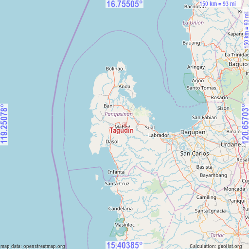
Tagudin GPS coordinates[2]
16° 4' 50.16" North, 119° 57' 14.04" East
| Map corner | latitude | longitude |
|---|---|---|
| Upper-left | 16.75505°, | 119.25078° |
| Center: | 16.0806°, | 119.9539° |
| Lower-right: | 15.40385°, | 120.65703° |
| Map W x H: | 150.2×150.2 km | = 93.3×93.3mi |
| max Lat: | 20.78733° ⇑11.6% North |
| Tagudin: | 16.0806° |
| min Lat: | ⇓88.4% South 4.65442° |
| min Long | Tagudin | max Long |
| 117.04868° | 119.9539° | 126.58417° |
| W 2.6%⇐ | ⇒97.4% E |
Elevation
Elevation of Tagudin is 54 m = 177 ft, and this is 33.9 m = 111 ft below average elevation for this country.
| Max E: |
2262 m = 7421 ft | 29.2% |
| Avg. | 87.9 m = 288 ft | |
| Tagudin | 54 m = 177 ft | |
Min E: |
-2 m = -7 ft | 70.8% |
See also: Philippines elevation on elevation.city.
Geographical zone
Tagudin is located in North Torrid zone (between Equator and Tropic of Cancer). Distance of this Northern Tropic circle is 817.9 km =508.2 mi to North.| Distance of | km | miles | from Tagudin |
|---|---|---|---|
| North Pole | 8219.1 | 5107.1 | to North |
| Arctic Circle | 5613.2 | 3487.9 | to North |
| Tropic Cancer | 817.9 | 508.2 | to North |
| Equator | 1788 | 1111 | to South |


Nearby cities:
15 places around Tagudin: (largest is in red/bold)
• Alaminos
8.9 km =5.5 mi,  19°
19°
• Bangan-Oda
13.5 km =8.4 mi,  283°
283°
• Banog Sur
11.2 km =7 mi,  327°
327°
• Bued
10.1 km =6.3 mi,  28°
28°
• Burgos
9.8 km =6.1 mi,  255°
255°
• Caabiangan
3.2 km =2 mi, 283°
• Cayungnan
13.7 km =8.5 mi,  295°
295°
• Dasol
12.6 km =7.8 mi,  217°
217°
• Lucap
13.3 km =8.3 mi, 22°
• Mabini
2 km =1.2 mi,  233°
233°
• Paitan Este
8.3 km =5.2 mi,  86°
86°
• Pangapisan
15.1 km =9.4 mi,  1°
1°
• Pangascasan
14.7 km =9.1 mi,  74°
74°
• Polo
12.9 km =8 mi,  357°
357°
• Sual
15.1 km =9.4 mi,  95°
95°
Sources, notices
• [Note1] Compared only with cities in Philippines existing in our database
• [Src1] Map data: © OpenStreetMap contributors (CC-BY-SA)
• [Src2] Other city data from geonames.org with taken over terms of usage.
• [Src3] Geographical zone / Annual Mean Temperature by Robert A. Rohde @ Wikipedia
