Caningay geodata
Caningay (Western Visayas) is a populated place; located in Philippines in Asia/Manila (GMT+8) time zone. With population of 3,296 people, there are 2221 cities with bigger population in this country. Compared to other cities in Philippines, 70% of cities are located further ↑North; 52.2% of cities are located further →East and 86.9% of cities have lower elevation than Caningay. Note1
Administrative division(s):
- Level 1: Western Visayas
- Level 2: Province of Negros Occidental
- Level 3: Candoni


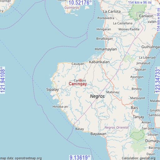
Caningay GPS coordinates[2]
9° 49' 46.92" North, 122° 38' 39.12" East
| Map corner | latitude | longitude |
|---|---|---|
| Upper-left | 10.52176°, | 121.94108° |
| Center: | 9.8297°, | 122.6442° |
| Lower-right: | 9.13619°, | 123.34733° |
| Map W x H: | 154.1×154.1 km | = 95.8×95.8mi |
| max Lat: | 20.78733° ⇑70% North |
| Caningay: | 9.8297° |
| min Lat: | ⇓30% South 4.65442° |
| min Long | Caningay | max Long |
| 117.04868° | 122.6442° | 126.58417° |
| W 47.8%⇐ | ⇒52.2% E |
Elevation
Elevation of Caningay is 165 m = 541 ft, and this is 77.1 m = 253 ft above average elevation for this country.
| Max E: |
2262 m = 7421 ft | 13.1% |
| Caningay | 165 m 541 ft | |
| Avg. | 87.9 m = 288 ft | |
Min E: |
-2 m = -7 ft | 86.9% |
See also: Philippines elevation on elevation.city.
Geographical zone
Caningay is located in North Torrid zone (between Equator and Tropic of Cancer). Distance of Equator is 1093 km =679.2 mi to South.| Distance of | km | miles | from Caningay |
|---|---|---|---|
| North Pole | 8914.1 | 5539 | to North |
| Arctic Circle | 6308.2 | 3919.7 | to North |
| Tropic Cancer | 1513 | 940.1 | to North |
| Equator | 1093 | 679.2 | to South |


Nearby cities:
15 places around Caningay: (largest is in red/bold)
• Bocana
21.9 km =13.6 mi,  22°
22°
• Cabadiangan
20.5 km =12.7 mi,  245°
245°
• Camindangan
10 km =6.2 mi,  350°
350°
• Candoni
4.6 km =2.9 mi, 252°
• Canturay
21.2 km =13.2 mi,  259°
259°
• Cawayan
15.9 km =9.9 mi, 352°
• Consuelo
22.6 km =14 mi,  33°
33°
• Daliciasao
21.6 km =13.4 mi,  36°
36°
• Dancalan
19.9 km =12.4 mi, 31°
• Guiljungan
17.1 km =10.6 mi,  11°
11°
• Manlucahoc
18.9 km =11.7 mi,  238°
238°
• Masaling
20.6 km =12.8 mi,  325°
325°
• Tabu
10 km =6.2 mi,  45°
45°
• Tiling
16 km =9.9 mi,  3°
3°
• Tuyum
18.9 km =11.7 mi, 330°
Sources, notices
• [Note1] Compared only with cities in Philippines existing in our database
• [Src1] Map data: © OpenStreetMap contributors (CC-BY-SA)
• [Src2] Other city data from geonames.org with taken over terms of usage.
• [Src3] Geographical zone / Annual Mean Temperature by Robert A. Rohde @ Wikipedia
