Calongbuyan geodata
Calongbuyan (Ilocos) is a populated place; located in Philippines in Asia/Manila (GMT+8) time zone. With population of 2,324 people, there are 3622 cities with bigger population in this country. Compared to other cities in Philippines, 94.5% of cities are located further ↓South; 93% of cities are located further →East and 95.5% of cities have higher elevation than Calongbuyan. Note1


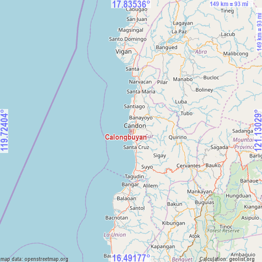
Calongbuyan GPS coordinates[2]
17° 9' 53.208" North, 120° 25' 37.776" East
| Map corner | latitude | longitude |
|---|---|---|
| Upper-left | 17.83536°, | 119.72404° |
| Center: | 17.16478°, | 120.42716° |
| Lower-right: | 16.49177°, | 121.13029° |
| Map W x H: | 149.4×149.4 km | = 92.8×92.8mi |
| max Lat: | 20.78733° ⇑5.5% North |
| Calongbuyan: | 17.16478° |
| min Lat: | ⇓94.5% South 4.65442° |
| min Long | Calongbuyan | max Long |
| 117.04868° | 120.42716° | 126.58417° |
| W 7%⇐ | ⇒93% E |
Elevation
Elevation of Calongbuyan is 5 m = 16 ft, and this is 82.9 m = 272 ft below average elevation for this country.
| Max E: |
2262 m = 7421 ft | 95.5% |
| Avg. | 87.9 m = 288 ft | |
| Calongbuyan | 5 m = 16 ft | |
Min E: |
-2 m = -7 ft | 4.5% |
See also: Philippines elevation on elevation.city.
Geographical zone
Calongbuyan is located in North Torrid zone (between Equator and Tropic of Cancer). Distance of this Northern Tropic circle is 697.4 km =433.3 mi to North.| Distance of | km | miles | from Calongbuyan |
|---|---|---|---|
| North Pole | 8098.5 | 5032.2 | to North |
| Arctic Circle | 5492.6 | 3412.9 | to North |
| Tropic Cancer | 697.4 | 433.3 | to North |
| Equator | 1908.5 | 1185.9 | to South |


Nearby cities:
15 places around Calongbuyan: (largest is in red/bold)
• Allangigan Primero
7 km =4.3 mi,  81°
81°
• Banayoyo
9.7 km =6 mi,  38°
38°
• Candon
4.2 km =2.6 mi, 38°
• Caterman
5.9 km =3.7 mi,  357°
357°
• Darapidap
4 km =2.5 mi,  346°
346°
• Galimuyod
5.2 km =3.2 mi,  65°
65°
• Lidlidda
15.3 km =9.5 mi, 40°
• Parioc Segundo
4.3 km =2.7 mi, 74°
• Patpata Segundo
2.2 km =1.4 mi,  17°
17°
• Salcedo
12 km =7.5 mi,  95°
95°
• San Esteban
18.5 km =11.5 mi,  5°
5°
• Santa Cruz
9.2 km =5.7 mi,  163°
163°
• Santa Lucia
5.9 km =3.7 mi,  152°
152°
• Santiago
14.5 km =9 mi, 7°
• Tablac
6.4 km =4 mi,  26°
26°
Sources, notices
• [Note1] Compared only with cities in Philippines existing in our database
• [Src1] Map data: © OpenStreetMap contributors (CC-BY-SA)
• [Src2] Other city data from geonames.org with taken over terms of usage.
• [Src3] Geographical zone / Annual Mean Temperature by Robert A. Rohde @ Wikipedia
