Burias geodata
Burias (Western Visayas) is a populated place; located in Philippines in Asia/Manila (GMT+8) time zone. With population of 4,281 people, there are 1594 cities with bigger population in this country. Compared to other cities in Philippines, 52% of cities are located further ↑North; 53.7% of cities are located further →East and 62.2% of cities have lower elevation than Burias. Note1


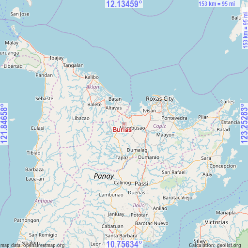
Burias GPS coordinates[2]
11° 26' 46.68" North, 122° 32' 58.92" East
| Map corner | latitude | longitude |
|---|---|---|
| Upper-left | 12.13459°, | 121.84658° |
| Center: | 11.4463°, | 122.5497° |
| Lower-right: | 10.75634°, | 123.25283° |
| Map W x H: | 153.2×153.3 km | = 95.2×95.3mi |
| max Lat: | 20.78733° ⇑52% North |
| Burias: | 11.4463° |
| min Lat: | ⇓48% South 4.65442° |
| min Long | Burias | max Long |
| 117.04868° | 122.5497° | 126.58417° |
| W 46.3%⇐ | ⇒53.7% E |
Elevation
Elevation of Burias is 37 m = 121 ft, and this is 50.9 m = 167 ft below average elevation for this country.
| Max E: |
2262 m = 7421 ft | 37.8% |
| Avg. | 87.9 m = 288 ft | |
| Burias | 37 m = 121 ft | |
Min E: |
-2 m = -7 ft | 62.2% |
See also: Philippines elevation on elevation.city.
Geographical zone
Burias is located in North Torrid zone (between Equator and Tropic of Cancer). Distance of Equator is 1272.7 km =790.8 mi to South.| Distance of | km | miles | from Burias |
|---|---|---|---|
| North Pole | 8734.4 | 5427.3 | to North |
| Arctic Circle | 6128.5 | 3808.1 | to North |
| Tropic Cancer | 1333.2 | 828.4 | to North |
| Equator | 1272.7 | 790.8 | to South |


Nearby cities:
15 places around Burias: (largest is in red/bold)
• Ag-ambulong
9.7 km =6 mi,  206°
206°
• Altavas
12.3 km =7.6 mi,  326°
326°
• Bilao
4.8 km =3 mi,  13°
13°
• Bula
2.1 km =1.3 mi,  84°
84°
• Damayan
5.3 km =3.3 mi,  4°
4°
• Dapdapan
10.4 km =6.5 mi,  59°
59°
• Jamindan
7.6 km =4.7 mi,  227°
227°
• Lonoy
7.3 km =4.5 mi, 3°
• Lucero
9.3 km =5.8 mi,  275°
275°
• Lupo
10.3 km =6.4 mi,  311°
311°
• Mambusao
5.5 km =3.4 mi,  105°
105°
• Mangoso
10.2 km =6.3 mi, 108°
• Manup
11 km =6.8 mi, 329°
• Sapian
7.9 km =4.9 mi,  47°
47°
• Sigma
13 km =8.1 mi,  102°
102°
Sources, notices
• [Note1] Compared only with cities in Philippines existing in our database
• [Src1] Map data: © OpenStreetMap contributors (CC-BY-SA)
• [Src2] Other city data from geonames.org with taken over terms of usage.
• [Src3] Geographical zone / Annual Mean Temperature by Robert A. Rohde @ Wikipedia
