Mangoso geodata
Mangoso (Western Visayas) is a populated place; located in Philippines in Asia/Manila (GMT+8) time zone. With population of 2,466 people, there are 3355 cities with bigger population in this country. Compared to other cities in Philippines, 52.3% of cities are located further ↑North; 52.4% of cities are located further →East and 54.5% of cities have higher elevation than Mangoso. Note1


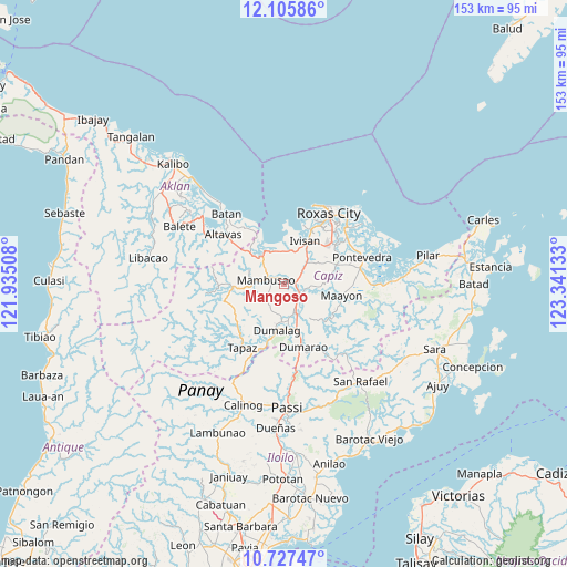
Mangoso GPS coordinates[2]
11° 25' 3" North, 122° 38' 17.52" East
| Map corner | latitude | longitude |
|---|---|---|
| Upper-left | 12.10586°, | 121.93508° |
| Center: | 11.4175°, | 122.6382° |
| Lower-right: | 10.72747°, | 123.34133° |
| Map W x H: | 153.3×153.3 km | = 95.3×95.3mi |
| max Lat: | 20.78733° ⇑52.3% North |
| Mangoso: | 11.4175° |
| min Lat: | ⇓47.7% South 4.65442° |
| min Long | Mangoso | max Long |
| 117.04868° | 122.6382° | 126.58417° |
| W 47.6%⇐ | ⇒52.4% E |
Elevation
Elevation of Mangoso is 20 m = 66 ft, and this is 67.9 m = 223 ft below average elevation for this country.
| Max E: |
2262 m = 7421 ft | 54.5% |
| Avg. | 87.9 m = 288 ft | |
| Mangoso | 20 m = 66 ft | |
Min E: |
-2 m = -7 ft | 45.5% |
See also: Philippines elevation on elevation.city.
Geographical zone
Mangoso is located in North Torrid zone (between Equator and Tropic of Cancer). Distance of Equator is 1269.5 km =788.8 mi to South.| Distance of | km | miles | from Mangoso |
|---|---|---|---|
| North Pole | 8737.6 | 5429.3 | to North |
| Arctic Circle | 6131.7 | 3810.1 | to North |
| Tropic Cancer | 1336.4 | 830.4 | to North |
| Equator | 1269.5 | 788.8 | to South |


Nearby cities:
15 places around Mangoso: (largest is in red/bold)
• Bula
8.3 km =5.2 mi,  294°
294°
• Burias
10.2 km =6.3 mi, 288°
• Consolacion
9.9 km =6.2 mi,  183°
183°
• Cuartero
9.2 km =5.7 mi,  158°
158°
• Dao
5.8 km =3.6 mi,  117°
117°
• Dapdapan
8.6 km =5.3 mi,  355°
355°
• Lacaron
11.3 km =7 mi,  87°
87°
• Malocloc
10.8 km =6.7 mi,  24°
24°
• Mambusao
4.7 km =2.9 mi, 292°
• Manjoy
7.8 km =4.8 mi, 156°
• Masonogan
6.8 km =4.2 mi,  143°
143°
• Mianay
9.1 km =5.7 mi,  48°
48°
• Parion
9.1 km =5.7 mi, 45°
• Sapian
9.4 km =5.8 mi,  335°
335°
• Sigma
3.1 km =1.9 mi,  81°
81°
Sources, notices
• [Note1] Compared only with cities in Philippines existing in our database
• [Src1] Map data: © OpenStreetMap contributors (CC-BY-SA)
• [Src2] Other city data from geonames.org with taken over terms of usage.
• [Src3] Geographical zone / Annual Mean Temperature by Robert A. Rohde @ Wikipedia
