Burdeos geodata
Burdeos (Calabarzon) is a populated place; located in Philippines in Asia/Manila (GMT+8) time zone. With population of 4,548 people, there are 1469 cities with bigger population in this country. Compared to other cities in Philippines, 76% of cities are located further ↓South; 60.6% of cities are located further →East and 76.6% of cities have higher elevation than Burdeos. Note1


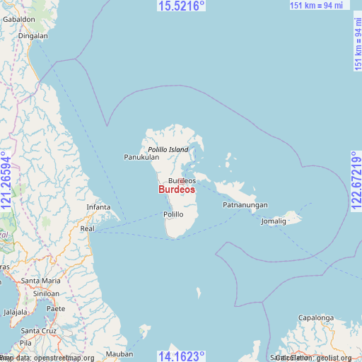
Burdeos GPS coordinates[2]
14° 50' 34.872" North, 121° 58' 8.616" East
| Map corner | latitude | longitude |
|---|---|---|
| Upper-left | 15.5216°, | 121.26594° |
| Center: | 14.84302°, | 121.96906° |
| Lower-right: | 14.1623°, | 122.67219° |
| Map W x H: | 151.1×151.1 km | = 93.9×93.9mi |
| max Lat: | 20.78733° ⇑24% North |
| Burdeos: | 14.84302° |
| min Lat: | ⇓76% South 4.65442° |
| min Long | Burdeos | max Long |
| 117.04868° | 121.96906° | 126.58417° |
| W 39.4%⇐ | ⇒60.6% E |
Elevation
Elevation of Burdeos is 10 m = 33 ft, and this is 77.9 m = 256 ft below average elevation for this country.
| Max E: |
2262 m = 7421 ft | 76.6% |
| Avg. | 87.9 m = 288 ft | |
| Burdeos | 10 m = 33 ft | |
Min E: |
-2 m = -7 ft | 23.4% |
See also: Philippines elevation on elevation.city.
Geographical zone
Burdeos is located in North Torrid zone (between Equator and Tropic of Cancer). Distance of this Northern Tropic circle is 955.5 km =593.7 mi to North.| Distance of | km | miles | from Burdeos |
|---|---|---|---|
| North Pole | 8356.7 | 5192.6 | to North |
| Arctic Circle | 5750.8 | 3573.4 | to North |
| Tropic Cancer | 955.5 | 593.7 | to North |
| Equator | 1650.4 | 1025.5 | to South |


Nearby cities:
15 places around Burdeos: (largest is in red/bold)
• Bantilan
33.6 km =20.9 mi,  253°
253°
• Banugao
39.1 km =24.3 mi, 254°
• Binulasan
31.7 km =19.7 mi, 246°
• Dinahican
30.6 km =19 mi,  242°
242°
• General Nakar
36.9 km =22.9 mi,  256°
256°
• Gumian
40.5 km =25.2 mi, 248°
• Infanta
36 km =22.4 mi, 252°
• Karligan
16.7 km =10.4 mi,  28°
28°
• Kiloloran
45.3 km =28.1 mi, 239°
• Panukulan
19.2 km =11.9 mi,  301°
301°
• Patnanungan
24 km =14.9 mi,  106°
106°
• Polillo
14.2 km =8.8 mi,  188°
188°
• Pulo
38.9 km =24.2 mi, 248°
• Real
44 km =27.3 mi, 243°
• Sibulan
11 km =6.8 mi,  200°
200°
Sources, notices
• [Note1] Compared only with cities in Philippines existing in our database
• [Src1] Map data: © OpenStreetMap contributors (CC-BY-SA)
• [Src2] Other city data from geonames.org with taken over terms of usage.
• [Src3] Geographical zone / Annual Mean Temperature by Robert A. Rohde @ Wikipedia
