Bungoy geodata
Bungoy (Calabarzon) is a populated place; located in Philippines in Asia/Manila (GMT+8) time zone. With population of 3,591 people, there are 1987 cities with bigger population in this country. Compared to other cities in Philippines, 69% of cities are located further ↓South; 69.2% of cities are located further →East and 81.2% of cities have lower elevation than Bungoy. Note1


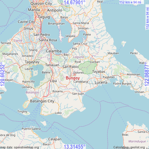
Bungoy GPS coordinates[2]
13° 59' 52.044" North, 121° 21' 56.304" East
| Map corner | latitude | longitude |
|---|---|---|
| Upper-left | 14.67901°, | 120.66252° |
| Center: | 13.99779°, | 121.36564° |
| Lower-right: | 13.31455°, | 122.06877° |
| Map W x H: | 151.7×151.7 km | = 94.3×94.3mi |
| max Lat: | 20.78733° ⇑31% North |
| Bungoy: | 13.99779° |
| min Lat: | ⇓69% South 4.65442° |
| min Long | Bungoy | max Long |
| 117.04868° | 121.36564° | 126.58417° |
| W 30.8%⇐ | ⇒69.2% E |
Elevation
Elevation of Bungoy is 101 m = 331 ft, and this is 13.1 m = 43 ft above average elevation for this country.
| Max E: |
2262 m = 7421 ft | 18.8% |
| Bungoy | 101 m 331 ft | |
| Avg. | 87.9 m = 288 ft | |
Min E: |
-2 m = -7 ft | 81.2% |
See also: Philippines elevation on elevation.city.
Geographical zone
Bungoy is located in North Torrid zone (between Equator and Tropic of Cancer). Distance of this Northern Tropic circle is 1049.5 km =652.1 mi to North.| Distance of | km | miles | from Bungoy |
|---|---|---|---|
| North Pole | 8450.7 | 5251 | to North |
| Arctic Circle | 5844.8 | 3631.8 | to North |
| Tropic Cancer | 1049.5 | 652.1 | to North |
| Equator | 1556.4 | 967.1 | to South |


Nearby cities:
15 places around Bungoy: (largest is in red/bold)
• Ayusan Uno
7.8 km =4.8 mi,  233°
233°
• Bukal Sur
7 km =4.3 mi,  162°
162°
• Cabatang
3.4 km =2.1 mi,  177°
177°
• Dagatan
1.3 km =0.8 mi,  69°
69°
• Dolores
5.5 km =3.4 mi,  60°
60°
• Lalig
4.6 km =2.9 mi,  248°
248°
• Lusacan
5.2 km =3.2 mi,  205°
205°
• Masalukot Uno
7.4 km =4.6 mi,  129°
129°
• Paiisa
8 km =5 mi,  188°
188°
• Quipot
6.9 km =4.3 mi, 226°
• San Pablo
9 km =5.6 mi,  331°
331°
• Santa Cruz
2.7 km =1.7 mi,  340°
340°
• Santa Lucia
8.2 km =5.1 mi, 59°
• Santisimo Rosario
6.1 km =3.8 mi,  268°
268°
• Tiaong
6.1 km =3.8 mi, 231°
Sources, notices
• [Note1] Compared only with cities in Philippines existing in our database
• [Src1] Map data: © OpenStreetMap contributors (CC-BY-SA)
• [Src2] Other city data from geonames.org with taken over terms of usage.
• [Src3] Geographical zone / Annual Mean Temperature by Robert A. Rohde @ Wikipedia
