Lalig geodata
Lalig (Calabarzon) is a populated place; located in Philippines in Asia/Manila (GMT+8) time zone. With population of 14,729 people, there are 455 cities with bigger population in this country. Compared to other cities in Philippines, 68.7% of cities are located further ↓South; 69.7% of cities are located further →East and 69.6% of cities have lower elevation than Lalig. Note1


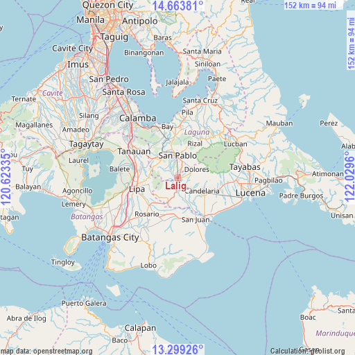
Lalig GPS coordinates[2]
13° 58' 57.18" North, 121° 19' 35.292" East
| Map corner | latitude | longitude |
|---|---|---|
| Upper-left | 14.66381°, | 120.62335° |
| Center: | 13.98255°, | 121.32647° |
| Lower-right: | 13.29926°, | 122.0296° |
| Map W x H: | 151.7×151.7 km | = 94.3×94.3mi |
| max Lat: | 20.78733° ⇑31.3% North |
| Lalig: | 13.98255° |
| min Lat: | ⇓68.7% South 4.65442° |
| min Long | Lalig | max Long |
| 117.04868° | 121.32647° | 126.58417° |
| W 30.3%⇐ | ⇒69.7% E |
Elevation
Elevation of Lalig is 51 m = 167 ft, and this is 36.9 m = 121 ft below average elevation for this country.
| Max E: |
2262 m = 7421 ft | 30.4% |
| Avg. | 87.9 m = 288 ft | |
| Lalig | 51 m = 167 ft | |
Min E: |
-2 m = -7 ft | 69.6% |
See also: Philippines elevation on elevation.city.
Geographical zone
Lalig is located in North Torrid zone (between Equator and Tropic of Cancer). Distance of this Northern Tropic circle is 1051.2 km =653.2 mi to North.| Distance of | km | miles | from Lalig |
|---|---|---|---|
| North Pole | 8452.3 | 5252 | to North |
| Arctic Circle | 5846.5 | 3632.8 | to North |
| Tropic Cancer | 1051.2 | 653.2 | to North |
| Equator | 1554.7 | 966 | to South |


Nearby cities:
15 places around Lalig: (largest is in red/bold)
• Ayusan Uno
3.6 km =2.2 mi,  214°
214°
• Bautista
5.4 km =3.4 mi,  284°
284°
• Bukal Sur
8.1 km =5 mi,  127°
127°
• Bungoy
4.6 km =2.9 mi,  68°
68°
• Cabatang
4.7 km =2.9 mi,  111°
111°
• Dagatan
5.8 km =3.6 mi, 68°
• Lusacan
3.6 km =2.2 mi,  146°
146°
• Paiisa
6.9 km =4.3 mi, 154°
• Quipot
3.1 km =1.9 mi,  194°
194°
• San Gregorio
8.5 km =5.3 mi,  307°
307°
• San Pablo
9.5 km =5.9 mi,  359°
359°
• Santa Cruz
5.4 km =3.4 mi,  38°
38°
• Santiago
6.7 km =4.2 mi, 310°
• Santisimo Rosario
2.4 km =1.5 mi, 309°
• Tiaong
2.2 km =1.4 mi,  195°
195°
Sources, notices
• [Note1] Compared only with cities in Philippines existing in our database
• [Src1] Map data: © OpenStreetMap contributors (CC-BY-SA)
• [Src2] Other city data from geonames.org with taken over terms of usage.
• [Src3] Geographical zone / Annual Mean Temperature by Robert A. Rohde @ Wikipedia
