Bulit geodata
Bulit (Autonomous Region in Muslim Mindanao) is a populated place; located in Philippines in Asia/Manila (GMT+8) time zone. With population of 2,219 people, there are 3849 cities with bigger population in this country. Compared to other cities in Philippines, 90.5% of cities are located further ↑North; 84.1% of cities are located further ←West and 56.1% of cities have higher elevation than Bulit. Note1
Administrative division(s):
- Level 1: Autonomous Region in Muslim Mindanao
- Level 2: Province of Maguindanao


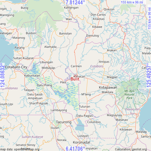
Bulit GPS coordinates[2]
7° 6' 55.008" North, 124° 47' 21.984" East
| Map corner | latitude | longitude |
|---|---|---|
| Upper-left | 7.81244°, | 124.08632° |
| Center: | 7.11528°, | 124.78944° |
| Lower-right: | 6.41706°, | 125.49257° |
| Map W x H: | 155.2×155.2 km | = 96.4×96.4mi |
| max Lat: | 20.78733° ⇑90.5% North |
| Bulit: | 7.11528° |
| min Lat: | ⇓9.5% South 4.65442° |
| min Long | Bulit | max Long |
| 117.04868° | 124.78944° | 126.58417° |
| W 84.1%⇐ | ⇒15.9% E |
Elevation
Elevation of Bulit is 19 m = 62 ft, and this is 68.9 m = 226 ft below average elevation for this country.
| Max E: |
2262 m = 7421 ft | 56.1% |
| Avg. | 87.9 m = 288 ft | |
| Bulit | 19 m = 62 ft | |
Min E: |
-2 m = -7 ft | 43.9% |
See also: Philippines elevation on elevation.city.
Geographical zone
Bulit is located in North Torrid zone (between Equator and Tropic of Cancer). Distance of Equator is 791.1 km =491.6 mi to South.| Distance of | km | miles | from Bulit |
|---|---|---|---|
| North Pole | 9215.9 | 5726.5 | to North |
| Arctic Circle | 6610 | 4107.3 | to North |
| Tropic Cancer | 1814.8 | 1127.7 | to North |
| Equator | 791.1 | 491.6 | to South |


Nearby cities:
15 places around Bulit: (largest is in red/bold)
• Banawa
9.5 km =5.9 mi,  63°
63°
• Carmen
9.9 km =6.2 mi,  1°
1°
• Gocoton
11.8 km =7.3 mi,  292°
292°
• Kabacan
4.5 km =2.8 mi,  102°
102°
• Layog
7.8 km =4.8 mi,  236°
236°
• Limbalod
2.2 km =1.4 mi,  28°
28°
• Malapag
3.6 km =2.2 mi, 56°
• Marbel
13.6 km =8.5 mi,  89°
89°
• Matalam
12.7 km =7.9 mi, 104°
• Nunguan
11.2 km =7 mi,  277°
277°
• Pagalungan
11.8 km =7.3 mi, 236°
• Pedtad
5.7 km =3.5 mi, 28°
• Pikit
14.6 km =9.1 mi, 242°
• Talitay
13.4 km =8.3 mi,  227°
227°
• Tungol
5.5 km =3.4 mi, 226°
Sources, notices
• [Note1] Compared only with cities in Philippines existing in our database
• [Src1] Map data: © OpenStreetMap contributors (CC-BY-SA)
• [Src2] Other city data from geonames.org with taken over terms of usage.
• [Src3] Geographical zone / Annual Mean Temperature by Robert A. Rohde @ Wikipedia
