Pagalungan geodata
Pagalungan (Autonomous Region in Muslim Mindanao) is a seat of a third-order administrative division; located in Philippines in Asia/Manila (GMT+8) time zone. With population of 5,932 people, there are 1064 cities with bigger population in this country. Compared to other cities in Philippines, 91.1% of cities are located further ↑North; 82.4% of cities are located further ←West and 73.2% of cities have higher elevation than Pagalungan. Note1
Administrative division(s):
- Level 1: Autonomous Region in Muslim Mindanao
- Level 2: Province of Maguindanao
- Level 3: Pagalungan


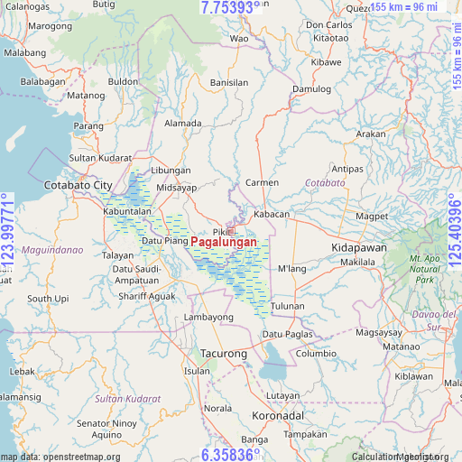
Pagalungan GPS coordinates[2]
7° 3' 24.012" North, 124° 42' 2.988" East
| Map corner | latitude | longitude |
|---|---|---|
| Upper-left | 7.75393°, | 123.99771° |
| Center: | 7.05667°, | 124.70083° |
| Lower-right: | 6.35836°, | 125.40396° |
| Map W x H: | 155.2×155.2 km | = 96.4×96.4mi |
| max Lat: | 20.78733° ⇑91.1% North |
| Pagalungan: | 7.05667° |
| min Lat: | ⇓8.9% South 4.65442° |
| min Long | Pagalungan | max Long |
| 117.04868° | 124.70083° | 126.58417° |
| W 82.4%⇐ | ⇒17.6% E |
Elevation
Elevation of Pagalungan is 11 m = 36 ft, and this is 76.9 m = 252 ft below average elevation for this country.
| Max E: |
2262 m = 7421 ft | 73.2% |
| Avg. | 87.9 m = 288 ft | |
| Pagalungan | 11 m = 36 ft | |
Min E: |
-2 m = -7 ft | 26.8% |
See also: Philippines elevation on elevation.city.
Geographical zone
Pagalungan is located in North Torrid zone (between Equator and Tropic of Cancer). Distance of Equator is 784.6 km =487.5 mi to South.| Distance of | km | miles | from Pagalungan |
|---|---|---|---|
| North Pole | 9222.4 | 5730.5 | to North |
| Arctic Circle | 6616.5 | 4111.3 | to North |
| Tropic Cancer | 1821.3 | 1131.7 | to North |
| Equator | 784.6 | 487.5 | to South |


Nearby cities:
15 places around Pagalungan: (largest is in red/bold)
• Buliok
4.4 km =2.7 mi,  181°
181°
• Bulit
11.8 km =7.3 mi,  56°
56°
• Gocoton
11.1 km =6.9 mi,  354°
354°
• Kabasalan
5.7 km =3.5 mi,  281°
281°
• Kalbugan
11.7 km =7.3 mi,  203°
203°
• Layog
4 km =2.5 mi, 55°
• Limbalod
13.7 km =8.5 mi,  51°
51°
• Manaulanan
9 km =5.6 mi,  263°
263°
• Nunguan
8.1 km =5 mi, 350°
• Pagangan
13.3 km =8.3 mi,  298°
298°
• Pikit
3.2 km =2 mi,  265°
265°
• Punolu
13 km =8.1 mi, 266°
• Talitay
2.6 km =1.6 mi, 182°
• Tinutulan
7.4 km =4.6 mi,  310°
310°
• Tungol
6.4 km =4 mi,  65°
65°
Sources, notices
• [Note1] Compared only with cities in Philippines existing in our database
• [Src1] Map data: © OpenStreetMap contributors (CC-BY-SA)
• [Src2] Other city data from geonames.org with taken over terms of usage.
• [Src3] Geographical zone / Annual Mean Temperature by Robert A. Rohde @ Wikipedia
