Pedtad geodata
Pedtad (Soccsksargen) is a populated place; located in Philippines in Asia/Manila (GMT+8) time zone. With population of 2,278 people, there are 3727 cities with bigger population in this country. Compared to other cities in Philippines, 89.9% of cities are located further ↑North; 84.8% of cities are located further ←West and 53.5% of cities have lower elevation than Pedtad. Note1


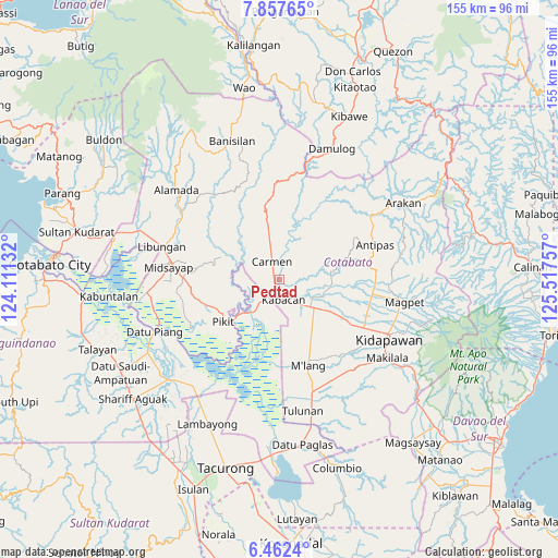
Pedtad GPS coordinates[2]
7° 9' 38.016" North, 124° 48' 51.984" East
| Map corner | latitude | longitude |
|---|---|---|
| Upper-left | 7.85765°, | 124.11132° |
| Center: | 7.16056°, | 124.81444° |
| Lower-right: | 6.4624°, | 125.51757° |
| Map W x H: | 155.1×155.1 km | = 96.4×96.4mi |
| max Lat: | 20.78733° ⇑89.9% North |
| Pedtad: | 7.16056° |
| min Lat: | ⇓10.1% South 4.65442° |
| min Long | Pedtad | max Long |
| 117.04868° | 124.81444° | 126.58417° |
| W 84.8%⇐ | ⇒15.2% E |
Elevation
Elevation of Pedtad is 26 m = 85 ft, and this is 61.9 m = 203 ft below average elevation for this country.
| Max E: |
2262 m = 7421 ft | 46.5% |
| Avg. | 87.9 m = 288 ft | |
| Pedtad | 26 m = 85 ft | |
Min E: |
-2 m = -7 ft | 53.5% |
See also: Philippines elevation on elevation.city.
Geographical zone
Pedtad is located in North Torrid zone (between Equator and Tropic of Cancer). Distance of Equator is 796.2 km =494.7 mi to South.| Distance of | km | miles | from Pedtad |
|---|---|---|---|
| North Pole | 9210.9 | 5723.4 | to North |
| Arctic Circle | 6605 | 4104.2 | to North |
| Tropic Cancer | 1809.7 | 1124.5 | to North |
| Equator | 796.2 | 494.7 | to South |


Nearby cities:
15 places around Pedtad: (largest is in red/bold)
• Banawa
5.8 km =3.6 mi,  97°
97°
• Bulit
5.7 km =3.5 mi,  208°
208°
• Carmen
5.5 km =3.4 mi,  332°
332°
• Gocoton
13.6 km =8.5 mi,  267°
267°
• Kabacan
6.2 km =3.9 mi,  164°
164°
• Layog
13.1 km =8.1 mi,  224°
224°
• Limbalod
3.5 km =2.2 mi, 209°
• Linao
16.9 km =10.5 mi,  87°
87°
• Malamote
16.9 km =10.5 mi,  124°
124°
• Malapag
3 km =1.9 mi,  175°
175°
• Marbel
11.9 km =7.4 mi,  114°
114°
• Matalam
12.6 km =7.8 mi,  130°
130°
• Nunguan
14.3 km =8.9 mi,  255°
255°
• Paatan
12.9 km =8 mi, 110°
• Tungol
11.2 km =7 mi, 217°
Sources, notices
• [Note1] Compared only with cities in Philippines existing in our database
• [Src1] Map data: © OpenStreetMap contributors (CC-BY-SA)
• [Src2] Other city data from geonames.org with taken over terms of usage.
• [Src3] Geographical zone / Annual Mean Temperature by Robert A. Rohde @ Wikipedia
