Bani geodata
Bani (Ilocos) is a seat of a third-order administrative division; located in Philippines in Asia/Manila (GMT+8) time zone. In our database, there are 4166 cities with bigger population. Compared to other cities in Philippines, 89.3% of cities are located further ↓South; 98.2% of cities are located further →East and 73.2% of cities have higher elevation than Bani. Note1


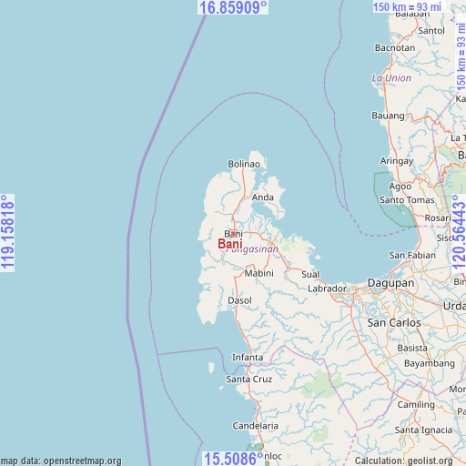
Bani GPS coordinates[2]
16° 11' 6" North, 119° 51' 40.68" East
| Map corner | latitude | longitude |
|---|---|---|
| Upper-left | 16.85909°, | 119.15818° |
| Center: | 16.185°, | 119.8613° |
| Lower-right: | 15.5086°, | 120.56443° |
| Map W x H: | 150.2×150.2 km | = 93.3×93.3mi |
| max Lat: | 20.78733° ⇑10.7% North |
| Bani: | 16.185° |
| min Lat: | ⇓89.3% South 4.65442° |
| min Long | Bani | max Long |
| 117.04868° | 119.8613° | 126.58417° |
| W 1.8%⇐ | ⇒98.2% E |
Elevation
Elevation of Bani is 11 m = 36 ft, and this is 76.9 m = 252 ft below average elevation for this country.
| Max E: |
2262 m = 7421 ft | 73.2% |
| Avg. | 87.9 m = 288 ft | |
| Bani | 11 m = 36 ft | |
Min E: |
-2 m = -7 ft | 26.8% |
See also: Philippines elevation on elevation.city.
Geographical zone
Bani is located in North Torrid zone (between Equator and Tropic of Cancer). Distance of this Northern Tropic circle is 806.3 km =501 mi to North.| Distance of | km | miles | from Bani |
|---|---|---|---|
| North Pole | 8207.5 | 5099.9 | to North |
| Arctic Circle | 5601.6 | 3480.7 | to North |
| Tropic Cancer | 806.3 | 501 | to North |
| Equator | 1799.6 | 1118.2 | to South |


Nearby cities:
15 places around Bani: (largest is in red/bold)
• Agno
10.1 km =6.3 mi,  220°
220°
• Alaminos
13.2 km =8.2 mi,  104°
104°
• Aloleng
10.4 km =6.5 mi,  234°
234°
• Bangan-Oda
9.1 km =5.7 mi,  201°
201°
• Banog Sur
4.5 km =2.8 mi,  119°
119°
• Bued
14.9 km =9.3 mi, 100°
• Burgos
14.1 km =8.8 mi,  178°
178°
• Caabiangan
12.8 km =8 mi,  148°
148°
• Catuday
13.3 km =8.3 mi,  333°
333°
• Cayungnan
6.3 km =3.9 mi, 203°
• Macabuboni
8.7 km =5.4 mi,  274°
274°
• Pangapisan
10.8 km =6.7 mi,  71°
71°
• Polo
9.5 km =5.9 mi,  82°
82°
• Ranao
5.5 km =3.4 mi,  297°
297°
• Tiep
5.9 km =3.7 mi,  359°
359°
Sources, notices
• [Note1] Compared only with cities in Philippines existing in our database
• [Src1] Map data: © OpenStreetMap contributors (CC-BY-SA)
• [Src2] Other city data from geonames.org with taken over terms of usage.
• [Src3] Geographical zone / Annual Mean Temperature by Robert A. Rohde @ Wikipedia
