Alaminos geodata
Alaminos (Ilocos) is a seat of a third-order administrative division; located in Philippines in Asia/Manila (GMT+8) time zone. With population of 10,488 people, there are 589 cities with bigger population in this country. Compared to other cities in Philippines, 89.1% of cities are located further ↓South; 97.2% of cities are located further →East and 62.8% of cities have higher elevation than Alaminos. Note1
Administrative division(s):
- Level 1: Ilocos
- Level 2: Province of Pangasinan
- Level 3: City of Alaminos


Alaminos GPS coordinates[2]
16° 9' 21.996" North, 119° 58' 51.996" East
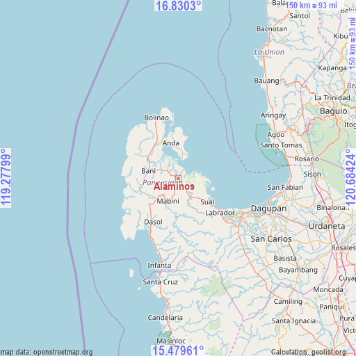
| Map corner | latitude | longitude |
|---|---|---|
| Upper-left | 16.8303°, | 119.27799° |
| Center: | 16.15611°, | 119.98111° |
| Lower-right: | 15.47961°, | 120.68424° |
| Map W x H: | 150.2×150.2 km | = 93.3×93.3mi |
| max Lat: | 20.78733° ⇑10.9% North |
| Alaminos: | 16.15611° |
| min Lat: | ⇓89.1% South 4.65442° |
| min Long | Alaminos | max Long |
| 117.04868° | 119.98111° | 126.58417° |
| W 2.8%⇐ | ⇒97.2% E |
Elevation
Elevation of Alaminos is 15 m = 49 ft, and this is 72.9 m = 239 ft below average elevation for this country.
| Max E: |
2262 m = 7421 ft | 62.8% |
| Avg. | 87.9 m = 288 ft | |
| Alaminos | 15 m = 49 ft | |
Min E: |
-2 m = -7 ft | 37.2% |
See also: Philippines elevation on elevation.city.
Geographical zone
Alaminos is located in North Torrid zone (between Equator and Tropic of Cancer). Distance of this Northern Tropic circle is 809.5 km =503 mi to North.| Distance of | km | miles | from Alaminos |
|---|---|---|---|
| North Pole | 8210.7 | 5101.9 | to North |
| Arctic Circle | 5604.8 | 3482.7 | to North |
| Tropic Cancer | 809.5 | 503 | to North |
| Equator | 1796.4 | 1116.2 | to South |


Nearby cities:
15 places around Alaminos: (largest is in red/bold)
• Agoo
15.1 km =9.4 mi,  122°
122°
• Bani
13.2 km =8.2 mi,  284°
284°
• Banog Sur
8.9 km =5.5 mi, 276°
• Bued
2 km =1.2 mi,  74°
74°
• Caabiangan
9.7 km =6 mi,  218°
218°
• Lucap
4.4 km =2.7 mi,  30°
30°
• Mabini
10.6 km =6.6 mi,  205°
205°
• Paitan Este
9.5 km =5.9 mi,  145°
145°
• Pangapisan
7.1 km =4.4 mi,  338°
338°
• Pangascasan
12.1 km =7.5 mi,  111°
111°
• Polo
5.6 km =3.5 mi,  322°
322°
• Sablig
12.6 km =7.8 mi,  3°
3°
• Tagudin
8.9 km =5.5 mi,  199°
199°
• Telbang
8.7 km =5.4 mi,  77°
77°
• Toritori
9.3 km =5.8 mi,  9°
9°
Sources, notices
• [Note1] Compared only with cities in Philippines existing in our database
• [Src1] Map data: © OpenStreetMap contributors (CC-BY-SA)
• [Src2] Other city data from geonames.org with taken over terms of usage.
• [Src3] Geographical zone / Annual Mean Temperature by Robert A. Rohde @ Wikipedia
