Polo geodata
Polo (Ilocos) is a populated place; located in Philippines in Asia/Manila (GMT+8) time zone. With population of 2,343 people, there are 3576 cities with bigger population in this country. Compared to other cities in Philippines, 89.4% of cities are located further ↓South; 97.5% of cities are located further →East and 57.6% of cities have higher elevation than Polo. Note1
Administrative division(s):
- Level 1: Ilocos
- Level 2: Province of Pangasinan
- Level 3: City of Alaminos


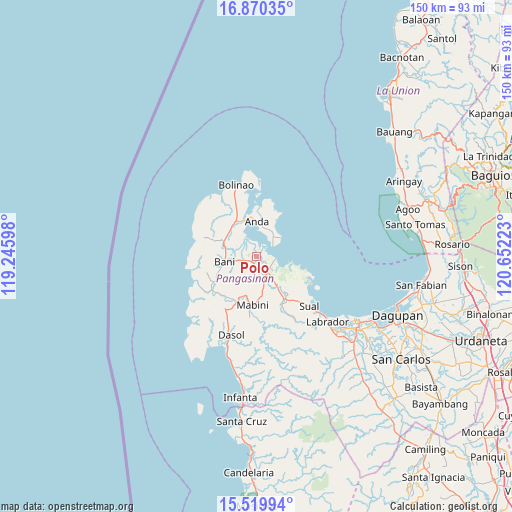
Polo GPS coordinates[2]
16° 11' 46.68" North, 119° 56' 56.76" East
| Map corner | latitude | longitude |
|---|---|---|
| Upper-left | 16.87035°, | 119.24598° |
| Center: | 16.1963°, | 119.9491° |
| Lower-right: | 15.51994°, | 120.65223° |
| Map W x H: | 150.2×150.2 km | = 93.3×93.3mi |
| max Lat: | 20.78733° ⇑10.6% North |
| Polo: | 16.1963° |
| min Lat: | ⇓89.4% South 4.65442° |
| min Long | Polo | max Long |
| 117.04868° | 119.9491° | 126.58417° |
| W 2.5%⇐ | ⇒97.5% E |
Elevation
Elevation of Polo is 18 m = 59 ft, and this is 69.9 m = 229 ft below average elevation for this country.
| Max E: |
2262 m = 7421 ft | 57.6% |
| Avg. | 87.9 m = 288 ft | |
| Polo | 18 m = 59 ft | |
Min E: |
-2 m = -7 ft | 42.4% |
See also: Philippines elevation on elevation.city.
Geographical zone
Polo is located in North Torrid zone (between Equator and Tropic of Cancer). Distance of this Northern Tropic circle is 805.1 km =500.3 mi to North.| Distance of | km | miles | from Polo |
|---|---|---|---|
| North Pole | 8206.2 | 5099.1 | to North |
| Arctic Circle | 5600.3 | 3479.9 | to North |
| Tropic Cancer | 805.1 | 500.3 | to North |
| Equator | 1800.9 | 1119 | to South |


Nearby cities:
15 places around Polo: (largest is in red/bold)
• Alaminos
5.6 km =3.5 mi,  142°
142°
• Anda
10.3 km =6.4 mi,  0°
0°
• Bani
9.5 km =5.9 mi,  262°
262°
• Banog Sur
6.4 km =4 mi,  237°
237°
• Bued
6.6 km =4.1 mi,  126°
126°
• Caabiangan
12.4 km =7.7 mi,  192°
192°
• Cayungnan
13.8 km =8.6 mi, 239°
• Lucap
5.7 km =3.5 mi,  96°
96°
• Mabini
14.1 km =8.8 mi,  184°
184°
• Pangapisan
2.3 km =1.4 mi,  21°
21°
• Sablig
9.1 km =5.7 mi,  27°
27°
• Tagudin
12.9 km =8 mi, 177°
• Telbang
12.2 km =7.6 mi, 102°
• Tiep
10.5 km =6.5 mi,  296°
296°
• Toritori
6.8 km =4.2 mi,  46°
46°
Sources, notices
• [Note1] Compared only with cities in Philippines existing in our database
• [Src1] Map data: © OpenStreetMap contributors (CC-BY-SA)
• [Src2] Other city data from geonames.org with taken over terms of usage.
• [Src3] Geographical zone / Annual Mean Temperature by Robert A. Rohde @ Wikipedia
