Balingueo geodata
Balingueo (Ilocos) is a populated place; located in Philippines in Asia/Manila (GMT+8) time zone. With population of 2,906 people, there are 2635 cities with bigger population in this country. Compared to other cities in Philippines, 86.8% of cities are located further ↓South; 93.5% of cities are located further →East and 67.4% of cities have higher elevation than Balingueo. Note1


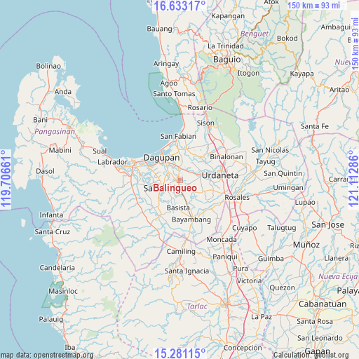
Balingueo GPS coordinates[2]
15° 57' 29.88" North, 120° 24' 35.028" East
| Map corner | latitude | longitude |
|---|---|---|
| Upper-left | 16.63317°, | 119.70661° |
| Center: | 15.9583°, | 120.40973° |
| Lower-right: | 15.28115°, | 121.11286° |
| Map W x H: | 150.3×150.3 km | = 93.4×93.4mi |
| max Lat: | 20.78733° ⇑13.2% North |
| Balingueo: | 15.9583° |
| min Lat: | ⇓86.8% South 4.65442° |
| min Long | Balingueo | max Long |
| 117.04868° | 120.40973° | 126.58417° |
| W 6.5%⇐ | ⇒93.5% E |
Elevation
Elevation of Balingueo is 13 m = 43 ft, and this is 74.9 m = 246 ft below average elevation for this country.
| Max E: |
2262 m = 7421 ft | 67.4% |
| Avg. | 87.9 m = 288 ft | |
| Balingueo | 13 m = 43 ft | |
Min E: |
-2 m = -7 ft | 32.6% |
See also: Philippines elevation on elevation.city.
Geographical zone
Balingueo is located in North Torrid zone (between Equator and Tropic of Cancer). Distance of this Northern Tropic circle is 831.5 km =516.7 mi to North.| Distance of | km | miles | from Balingueo |
|---|---|---|---|
| North Pole | 8232.7 | 5115.6 | to North |
| Arctic Circle | 5626.8 | 3496.3 | to North |
| Tropic Cancer | 831.5 | 516.7 | to North |
| Equator | 1774.4 | 1102.6 | to South |


Nearby cities:
15 places around Balingueo: (largest is in red/bold)
• Bolaoit
3.7 km =2.3 mi,  142°
142°
• Botao
4.7 km =2.9 mi,  170°
170°
• Bulog
0.9 km =0.6 mi,  283°
283°
• Doyong
6.2 km =3.9 mi, 284°
• Loqueb Este
4.2 km =2.6 mi,  111°
111°
• Malabago
6 km =3.7 mi,  295°
295°
• Malanay
5.6 km =3.5 mi,  359°
359°
• Malasiqui
4.3 km =2.7 mi, 173°
• Maticmatic
5.5 km =3.4 mi,  55°
55°
• Patayac
1.5 km =0.9 mi,  69°
69°
• Polong Norte
6.3 km =3.9 mi, 168°
• Santa Barbara
4.8 km =3 mi,  350°
350°
• Sonquil
3.9 km =2.4 mi,  328°
328°
• Talospatang
5.7 km =3.5 mi, 143°
• Taloy
4.1 km =2.5 mi,  200°
200°
Sources, notices
• [Note1] Compared only with cities in Philippines existing in our database
• [Src1] Map data: © OpenStreetMap contributors (CC-BY-SA)
• [Src2] Other city data from geonames.org with taken over terms of usage.
• [Src3] Geographical zone / Annual Mean Temperature by Robert A. Rohde @ Wikipedia
