Malanay geodata
Malanay (Ilocos) is a populated place; located in Philippines in Asia/Manila (GMT+8) time zone. With population of 4,098 people, there are 1667 cities with bigger population in this country. Compared to other cities in Philippines, 87.7% of cities are located further ↓South; 93.5% of cities are located further →East and 73.2% of cities have higher elevation than Malanay. Note1


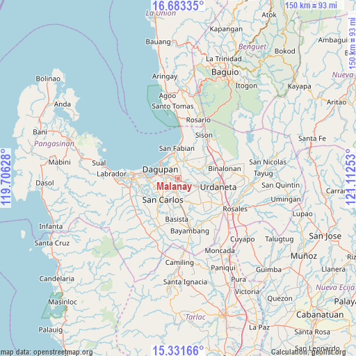
Malanay GPS coordinates[2]
16° 0' 31.14" North, 120° 24' 33.84" East
| Map corner | latitude | longitude |
|---|---|---|
| Upper-left | 16.68335°, | 119.70628° |
| Center: | 16.00865°, | 120.4094° |
| Lower-right: | 15.33166°, | 121.11253° |
| Map W x H: | 150.3×150.3 km | = 93.4×93.4mi |
| max Lat: | 20.78733° ⇑12.3% North |
| Malanay: | 16.00865° |
| min Lat: | ⇓87.7% South 4.65442° |
| min Long | Malanay | max Long |
| 117.04868° | 120.4094° | 126.58417° |
| W 6.5%⇐ | ⇒93.5% E |
Elevation
Elevation of Malanay is 11 m = 36 ft, and this is 76.9 m = 252 ft below average elevation for this country.
| Max E: |
2262 m = 7421 ft | 73.2% |
| Avg. | 87.9 m = 288 ft | |
| Malanay | 11 m = 36 ft | |
Min E: |
-2 m = -7 ft | 26.8% |
See also: Philippines elevation on elevation.city.
Geographical zone
Malanay is located in North Torrid zone (between Equator and Tropic of Cancer). Distance of this Northern Tropic circle is 825.9 km =513.2 mi to North.| Distance of | km | miles | from Malanay |
|---|---|---|---|
| North Pole | 8227.1 | 5112.1 | to North |
| Arctic Circle | 5621.2 | 3492.9 | to North |
| Tropic Cancer | 825.9 | 513.2 | to North |
| Equator | 1780 | 1106 | to South |


Nearby cities:
15 places around Malanay: (largest is in red/bold)
• Balingueo
5.6 km =3.5 mi,  179°
179°
• Bulog
5.4 km =3.4 mi,  188°
188°
• Calasiao
5.3 km =3.3 mi,  272°
272°
• Doyong
7.2 km =4.5 mi,  235°
235°
• Loqueb Este
8.1 km =5 mi,  151°
151°
• Malabago
6.2 km =3.9 mi, 240°
• Mangaldan
6.9 km =4.3 mi,  353°
353°
• Mapandan
5.2 km =3.2 mi,  69°
69°
• Maticmatic
5.2 km =3.2 mi,  118°
118°
• Nilombot
3.8 km =2.4 mi,  50°
50°
• Patayac
5.3 km =3.3 mi,  164°
164°
• San Jacinto
7.8 km =4.8 mi,  23°
23°
• Santa Barbara
1.1 km =0.7 mi,  221°
221°
• Sonquil
3 km =1.9 mi, 221°
• Tebag East
6.9 km =4.3 mi, 116°
Sources, notices
• [Note1] Compared only with cities in Philippines existing in our database
• [Src1] Map data: © OpenStreetMap contributors (CC-BY-SA)
• [Src2] Other city data from geonames.org with taken over terms of usage.
• [Src3] Geographical zone / Annual Mean Temperature by Robert A. Rohde @ Wikipedia
